
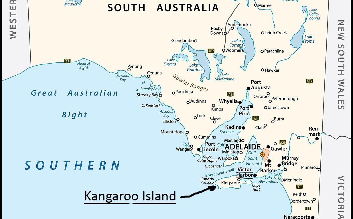
Kangaroo Island (KI) was one goal of this trip I managed to fulfill. After R&R at Venus Bay, I headed to Port Elliot (a few miles east of Victor Harbor) showgrounds RV camp. It is close to Cape Jervis and the ferry I needed to catch early the next morning. It only takes 45-minutes from Capre Jervis to Kangaroo Island. Australia has a number of offshore islands of interest, but this was my first. The Port Elliot showgrounds were a pleasant surprise. Inland birds were more in evidence than in any of my previous camps.
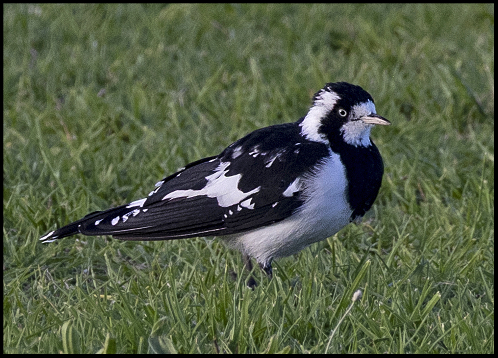
Magpie Lark
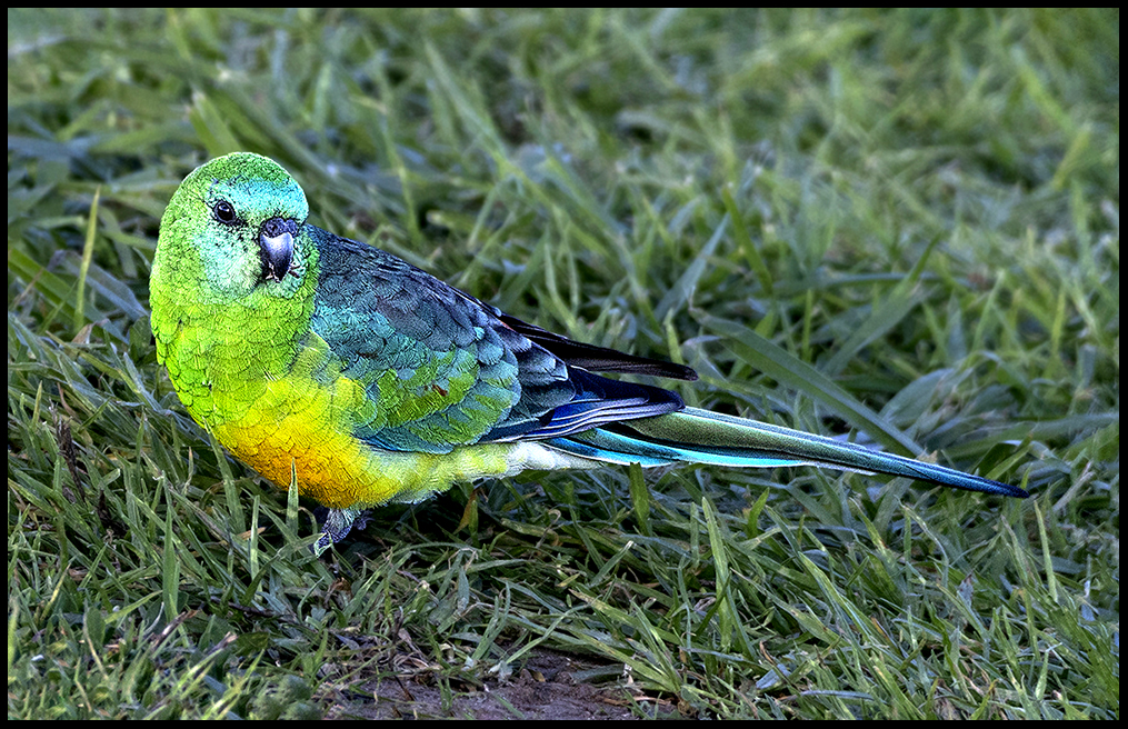
Red-rumped Parrot, male. The red rump is visible when they fly.
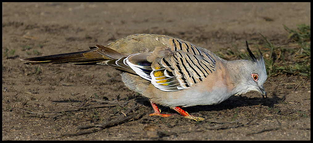
Crested Pigeon. These are members of the bronzewing group of pigeons native to OZ which have distinctive iridescent wing patches.
In the evening hundreds, maybe thousands of cockatoos fly in to roost in the showground trees. The noise and activity of the incoming flocks was amazing.
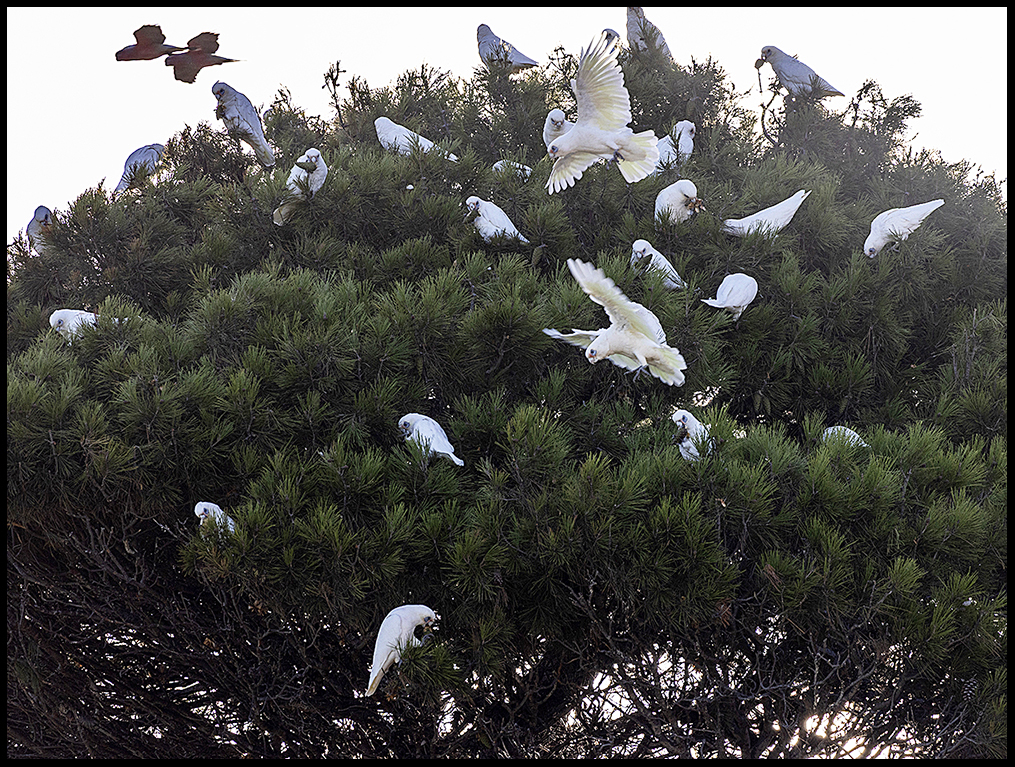
At twilight, huge flocks of galahs and little corellas swarm into roosting trees.
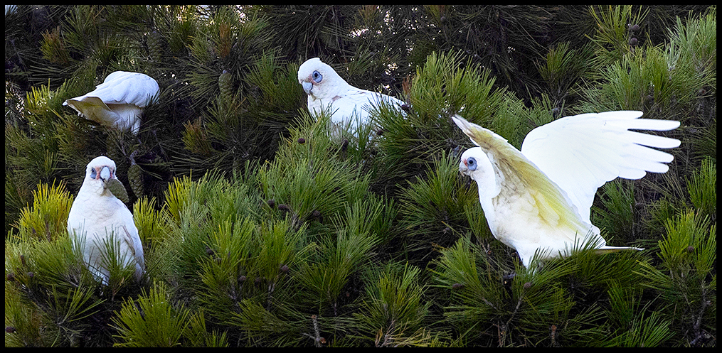
Closer look at the Little Corellas feeding.
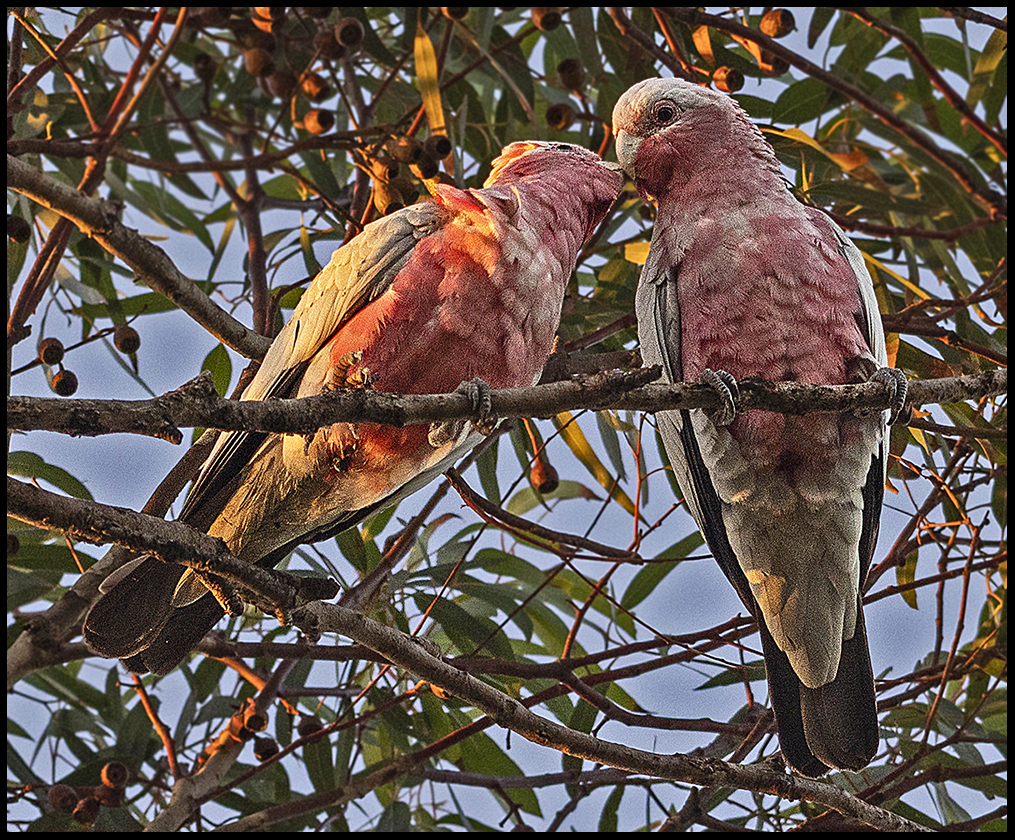
A pair of Galah cockatoos kiss goodnight in the tree above me.
I had to leave by 8 AM to catch the ferry…a difficult proposition for a slow starter like me. But out my camper door a field full of galah cockatoos got me going. Beautiful, noisy birds.
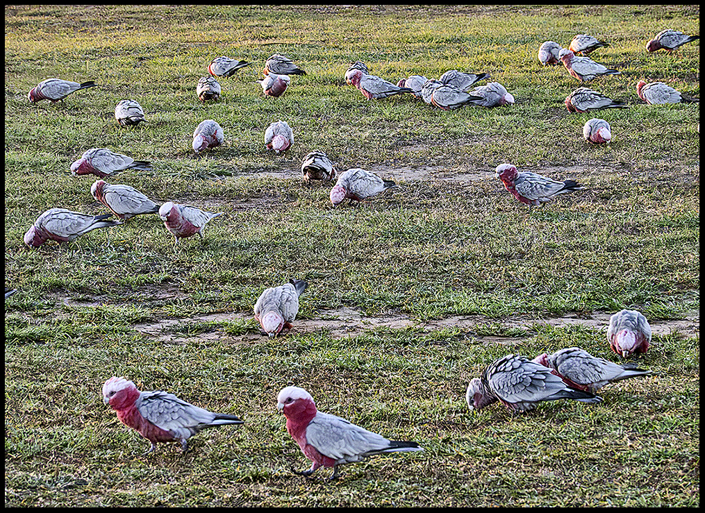
Galahs in the morning
The native population that once occupied Kangaroo Island island disappeared from the archaeological record sometime after the land became an island following rising sea levels around 10,000 years ago. It was subsequently occupied intermittently by fur seal hunters and whalers in the early 1800s. From 1836, with British colonization, people settled permanently.
Kangaroo Island is now a popular, nature-based tourist destination located 8 miles off the coast of South Australia, roughly 70 miles southwest of Adelaide. Only about 5,000 people call it home. That number could dwindle further with an aging population and young people moving to the mainland. It is Australia’s third-largest island, Tasmania being the largest. Famous for the rugged coastline and wildlife, the 96-mile-long island is a sanctuary for introduced wild kangaroos, koalas, and echidnas. Sea lions and fur seals bask on rocks along the southern coast. Besides tourism, agriculture provides income…wine grapes, honey, wool, meat (beef and mutton) and canola. Very strict quarantine rules protect the local honey industry which raises the rare, purebred Ligurian bee.
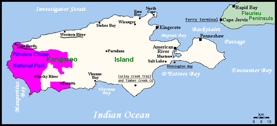
Island map with noted areas I visited.
As usual, I ferried over without a clue where to go upon arrival. I left the populated area around Penneshaw for the north coast. But to get there one must cross the narrow area near Pennington Bay.
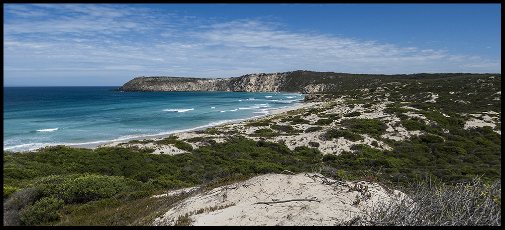
The gorgeous Pennington Bay is a favorite spot for beach activities.
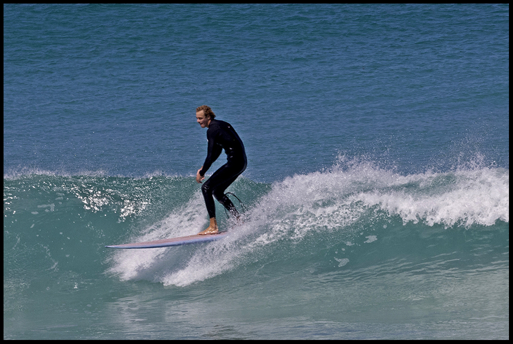
Surfers, picnickers and swimmers enjoy the surf and sun.
On to the scenic and lightly populated north shore and its dirt roads.
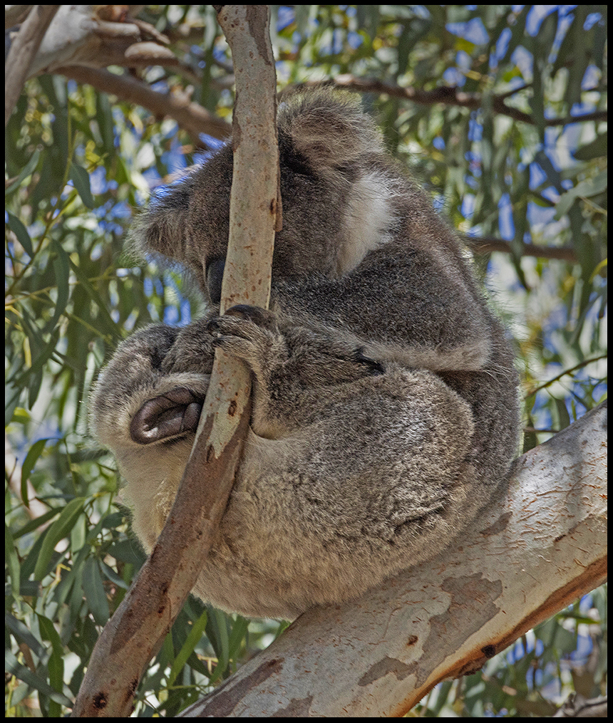
At Stokes Bay I found a sleepy koala and a lovely campground but I pushed on to find a less crowded one.
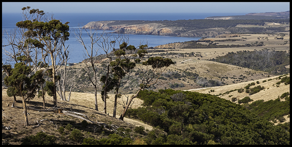
The rugged north shore in autumn (March). The June solstice is the start of winter down under.
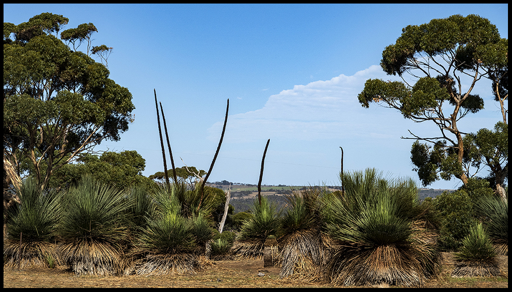
Typical plants.
I chose the Western River Cove campground along the shore. There were only a few other campers. The road in is steep and curvy. Large RVs and trailer-campers are prohibited. My kind of place.
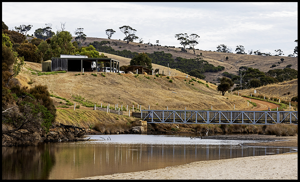
Western River Cove. 8 campsites
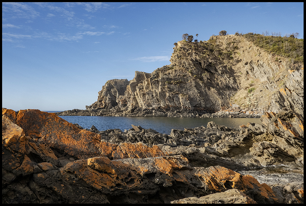
Cross the foot bridge and follow the river to the mouth, and one finds a lovely beach and amazing rocks.
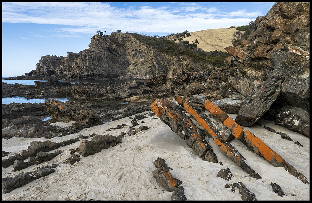
Rugged rocks flank the beach area. And more rocks below. I love the orange lichen.
Across the valley from my campsite were grazing sheep (there are a lot of sheep on KI), some kangaroos, a tree growing at an odd angle and a white-faced heron in deep grass, an unusual spot to find a heron.
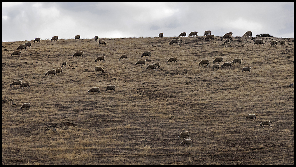
Ubiquitous sheep
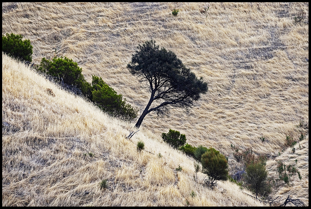
Which way is up?
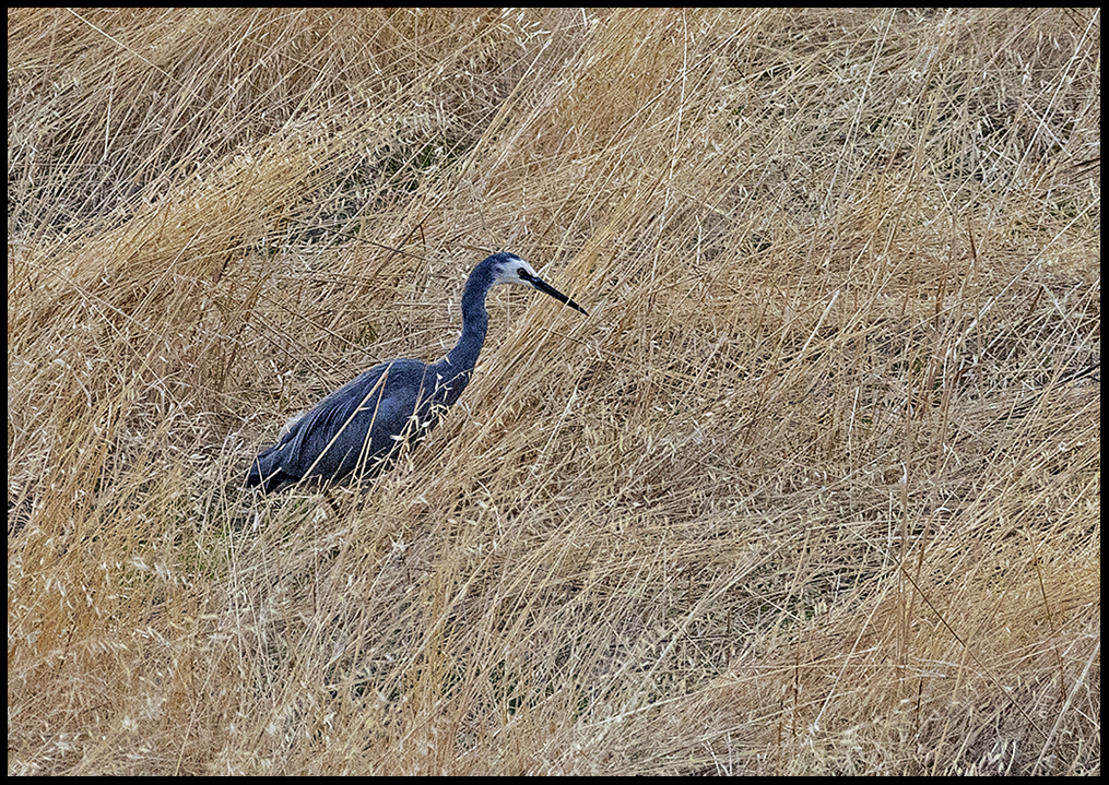
White-faced Heron
Most of the roads on the island are dirt, some in better shape than others. Traffic on these roads is minimal.The larger campers stick to the paved roads with occasional paved offshoots to touristy coastal areas. On to Cape Borda. The Cape Borda lighthouse was built in 1858, the only square stone lighthouse in South Australia.
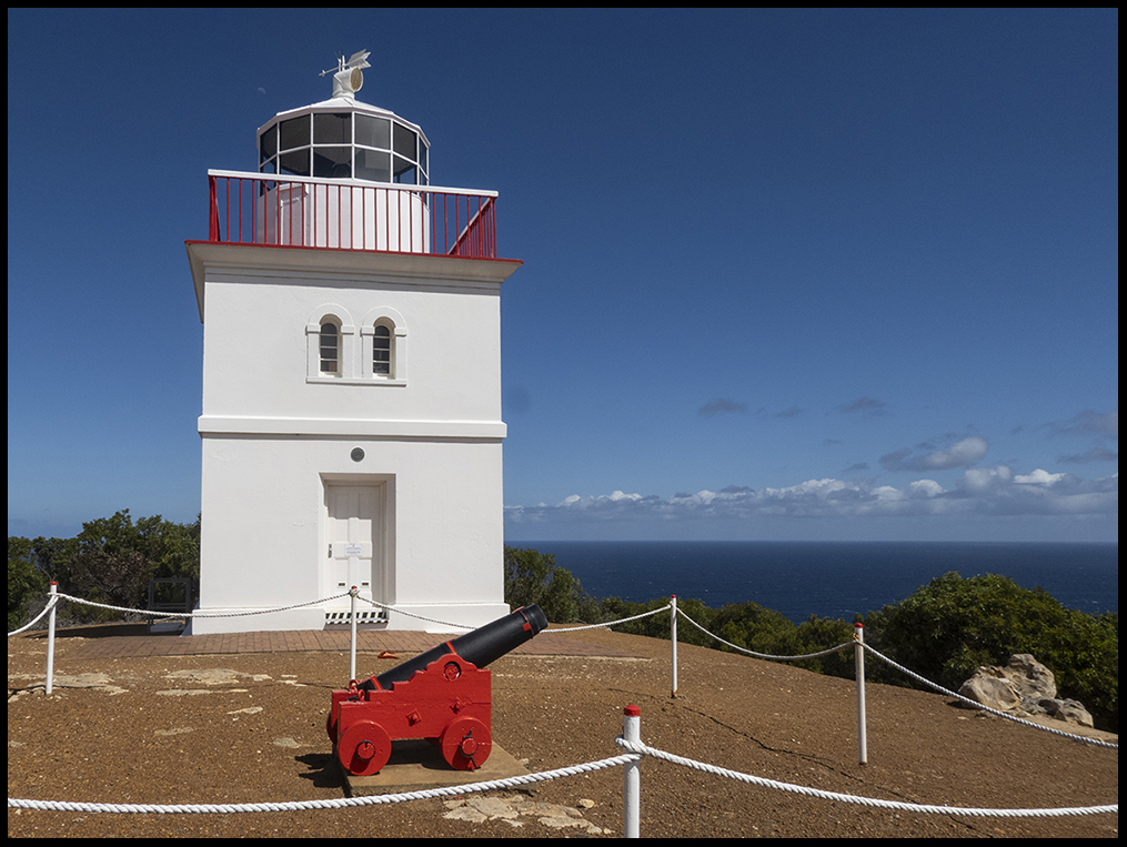
Cape Borda Lighthouse
Originally there was no road linking Cape Borda to the rest of the island and all supplies were hauled up from ships docking every three months at a nearby cove known as Harvey’s Return. There is a campground there now and a VERY steep trail to the cove.
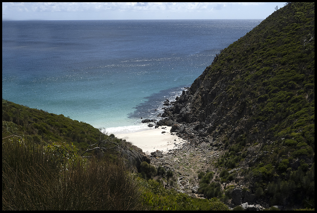
Harvey’s Return beach below via a VERY steep trail.
The island is subject to bushfires in the summer (as is the mainland), and suffered particularly devastating fires in 2020. The fires burned more than 520,000 acres; about 52 percent of the island. Signs of these fires are evident 6 years later. Even though the hardy vegetation is rebounding nicely, there aren’t many big trees left.
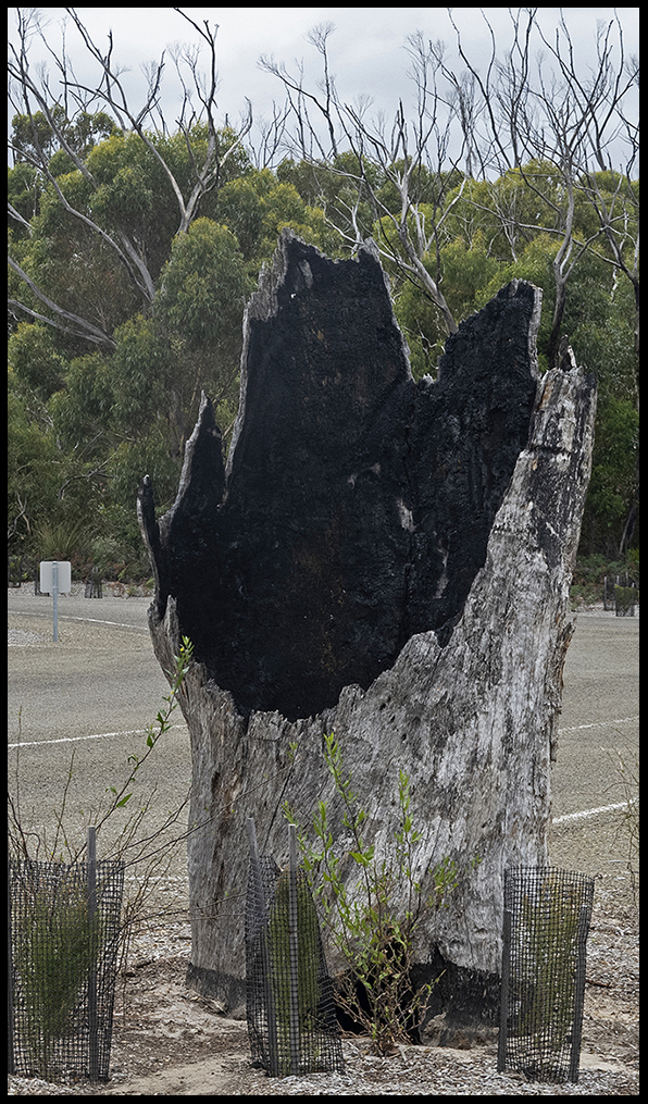
A burned stump of a large tree in the middle of the parking lot at park headquarters
As a result of the fires an estimated 80% of the 50,000 koalas on the island died which is why they are much harder to find now. Foxes and rabbits (introduced scourges on the mainland) are absent on KI, but feral cats on the other hand, are top predators of native species. Islanders are trying to eliminate all cats. People’s pet cats must be registered and micro-chipped.
Flinders Chase National Park covers most of the western end of the island. The interior of the park is difficult-to-access scrub, but the southern coastal area is very popular. They have a lovely campground which I took advantage of (showers, covered picnic tables, the always available barbies, etc.)
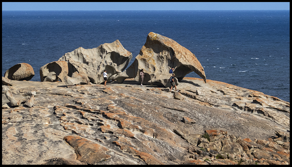
The Remarkable Rocks are a visitor favorite. The rocks are formed of weathered granite (composed of quartz, feldspar, and mica).
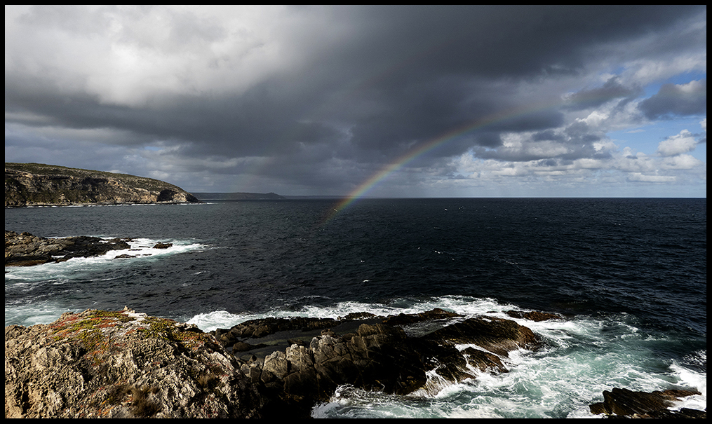
The shoreline near the other famous formation, the Admiral’s Arch
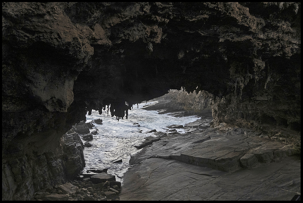
The Admiral’s Arch from the inside looking out.
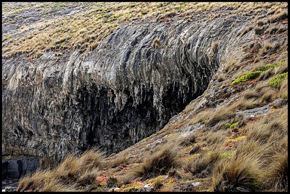
And from the outside looking in.
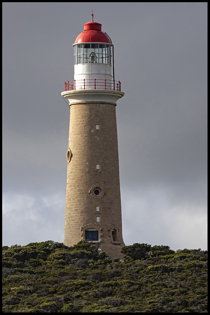
Cape du Couedic lighthouse
The second of 4 lighthouses on the island is near Admiral’s Arch; the Cape du Couedic lighthouse. The lighthouse and 4 cottages were built of native stone from 1906 to 1909. Like at Cape Borda, steamships supplied the lighthouse keepers and their families only every 3 months. Not until the 1940’s did a rough track and a sturdy truck start delivering goods to the lighthouse keeper more frequently.
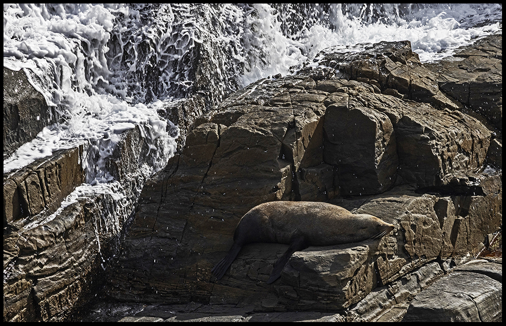
On the rocks near the lighthouse, lounge lots of fur seals. This one is a loner, but on other rocks old and young bask together.
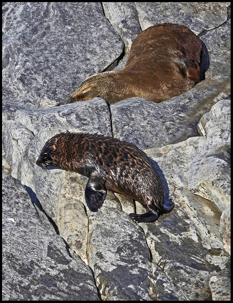
A youngster hauls out near mom.
Up until the 1830’s fur seals were prized for their pelts and sealers took advantage. Because the species (then known as New Zealand fur seals) was hunted to near extinction, the remaining population was too depleted to support commercial trade. The market collapsed. Strict government protections went into effect allowing the seals to recover. But decreasing demand permanently ended the industry. This species of seal has incredibly thick fur (up to 15,000 hairs per square centimeter!) that keeps water from reaching their skin. Hundreds rest here between long feeding trips at sea.
There is another big attraction on the south shore further east where barking sea lions delight tourists. Sea lions don’t have such thick coats so they get cold and huddle together to keep warm when the temperatures dip.
Not far from the lighthouse is Weirs cove.

Storehouse at Weirs Cove.
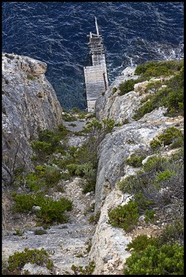
The 295 foot cliff and loading dock at Weirs cove.
The families stored their fuel and non-perishables in a storehouse at at the top of the cliff. Building materials and everything else needed to be hauled up the 295-foot cliff on foot. Eventually, they built some sort of mechanical lift to winch up everything including people.
Moving east along the southern shore I stopped at Kelly Hill caves. But, the caves were closed so took a walk on a loop trail there and then moved on. The caves are formed in limestone, but it’s a geologically young and different type of limestone formed of shell fragments and sand dunes. However, from the photos online, the caves look like pretty standard limestone caves.
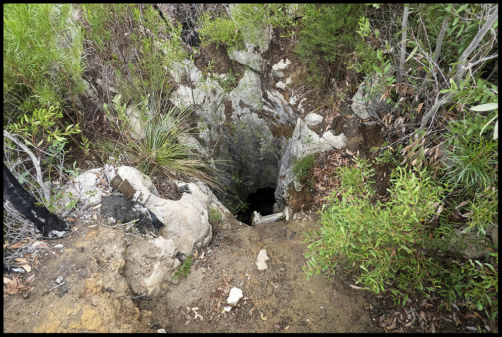
Cave exit along the trail. Doubt tourists use this ladder.
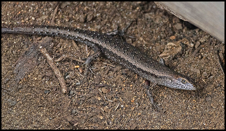
Reptilian wildlife.
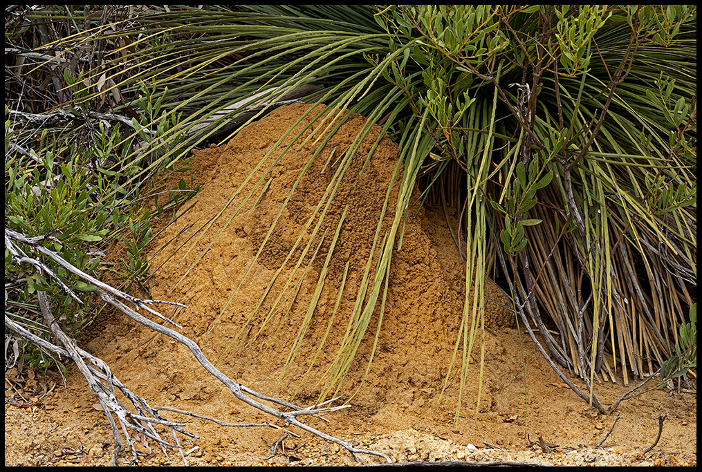
There are so many sizes and shapes of termite mounds. These rounded dome homes are built by forest termites. There are hundreds of termite species in OZ, but only a few species build large structures.
Roadside attractions follow.
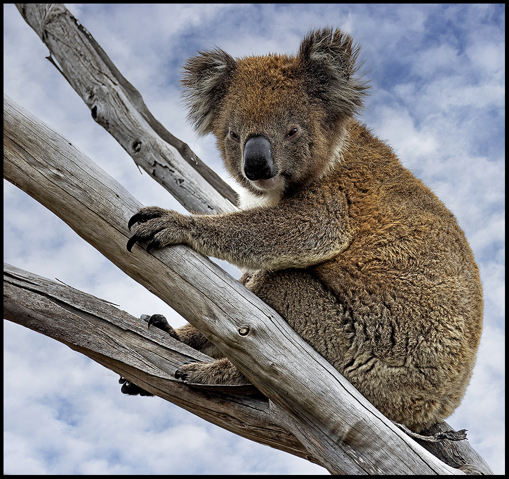
A koala in a dead tree right next to the highway
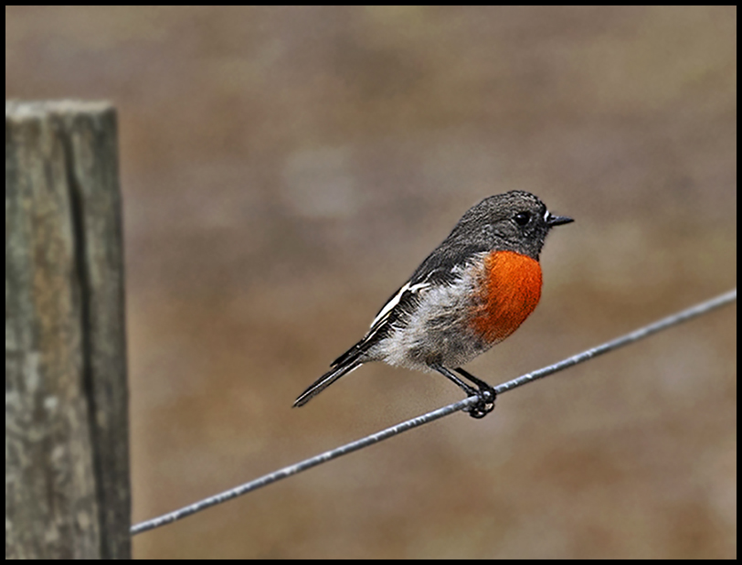
A flame robin was on the fence I had to climb over to get to…
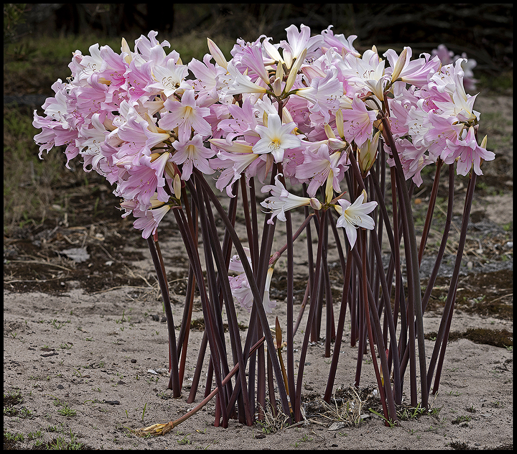
…some sort of leafless lilies in a field. There were a lot of them.
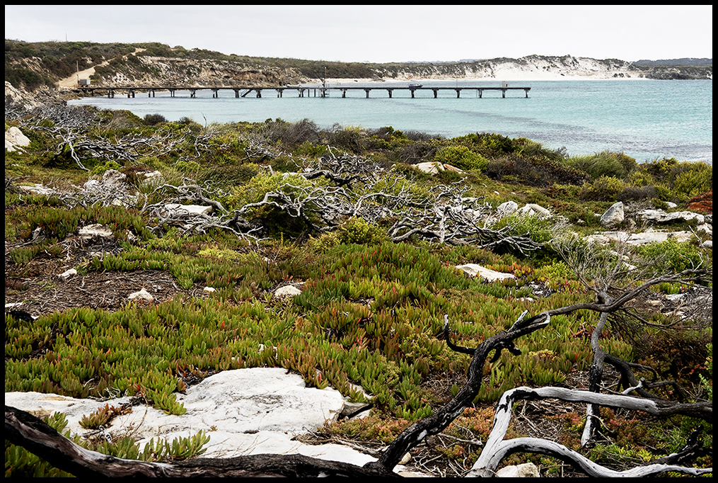
The weather was deteriorating by the time I walked out to Point Ellen.
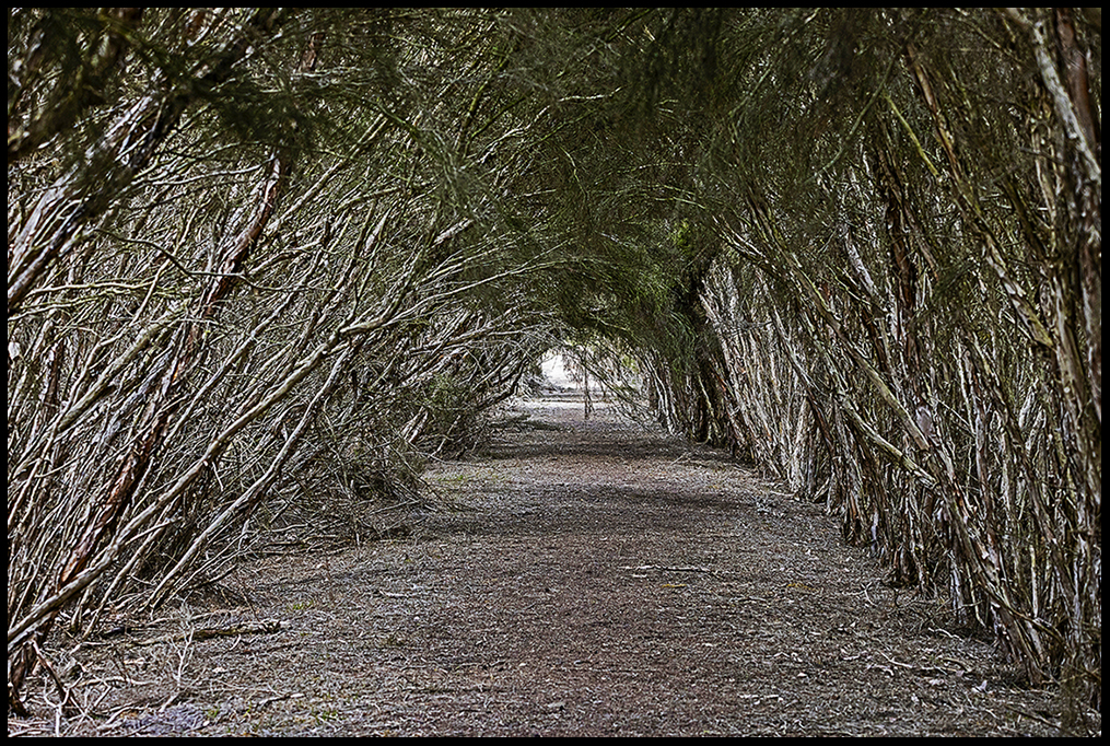
Stopped at Curley Creek for a walk…no one else was there.
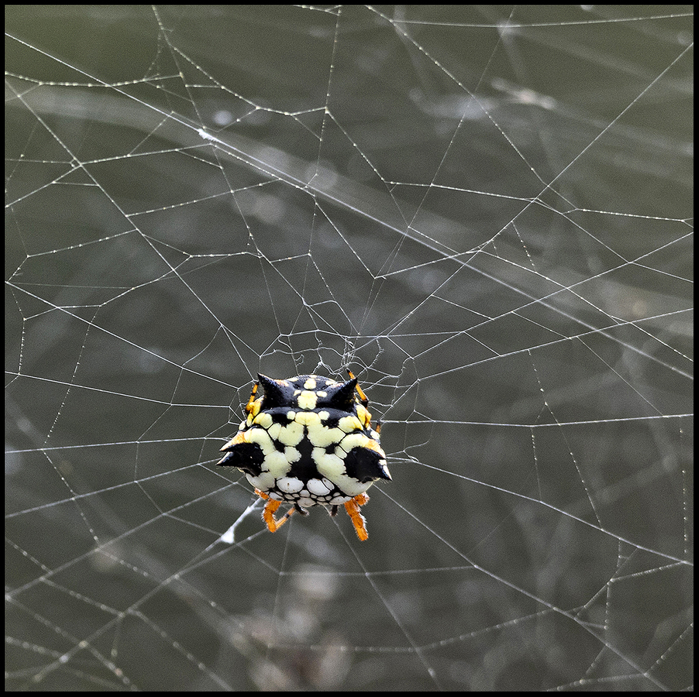
I found a colony of these small, colorful Australian jewel spiders.
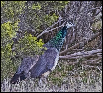
A wild peahen was a surprise.
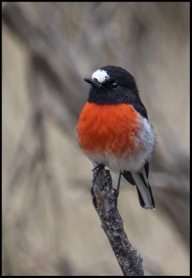
A scarlet robin along the trail.
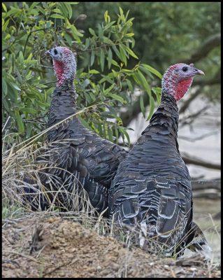
Also odd, was a flock of imported wild turkeys.
After a night at Timber Creek campground, the weather quickly deteriorated. High winds and dark, glowering skies didn’t make another night camping on the island look appealing so I booked a passage back to the mainland a day early. There, the weather was windy, but sunny.
It was too early to camp at Port Elliot again, so I found an interesting, free campsite listed in the camping bible provide by the Spaceship folks. That’s where I’ll start my next post. I’m including a photo of a weird pink lake on Kangaroo Is. and a small photo of a leafy seadragon to tempt my diver friends with tales of other people’s great scuba adventures off the north coast.
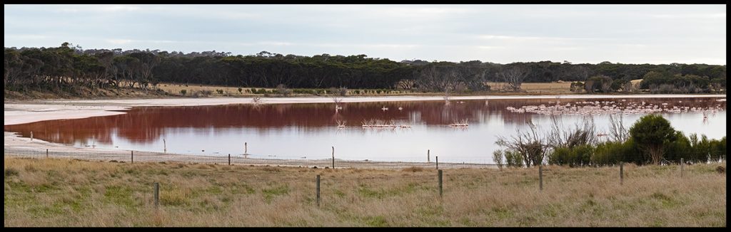
Strange pink lake.
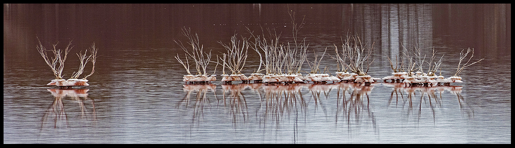
Close-up of the salt deposits around vegetation in the lake.
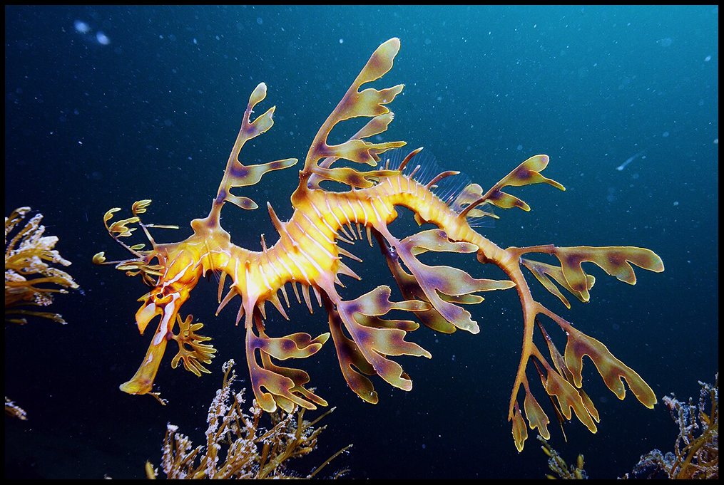
Leafy Seadragon off Kangaroo Island photo from Wikipedia