
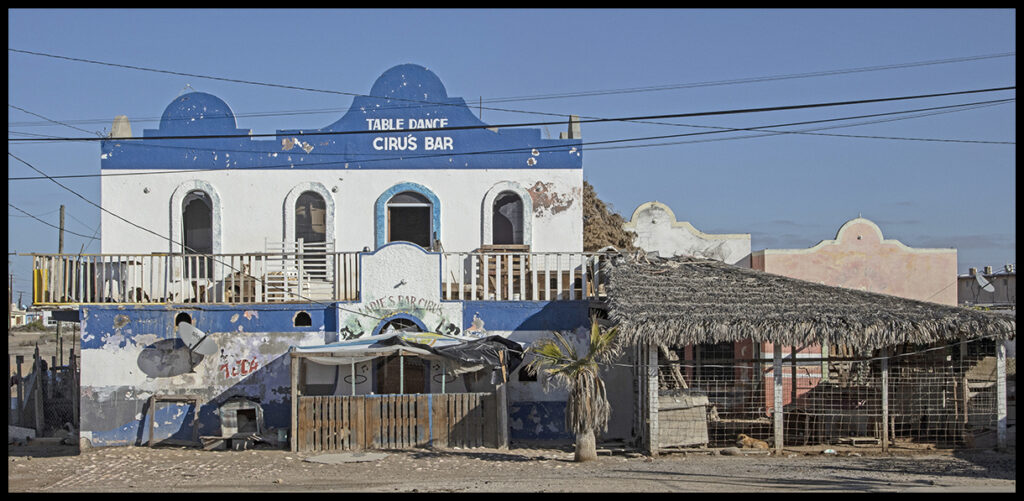
Repurposed Guerrero Negro building
On the border between the northern (Norte) and southern (Sur) states of Baja California lies the uninspiring town of Guerrero Negro. This soulless city’s first claim to fame and its reason for being, is one of the largest salt export businesses in the world. Their second claim to fame is the nearby Laguna de Ojo de Liebre, one of only three bays where Pacific gray whales mate and give birth before returning north to feed. Whale watching (and petting) businesses keep the town busy with tourists from the end of December through March.
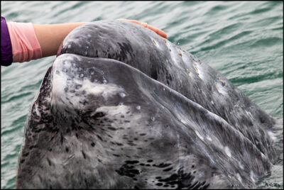
Petting a baby gray whale.
The other two bays are further south, so this one sees many tourists driving down from the states as well as many European visitors.
The town, founded in 1957, was named after the Black Warrior (Guerrero Negro in Spanish), a U.S. American whaling ship wrecked 100 years earlier in what was then called Frenchman’s Lagoon.
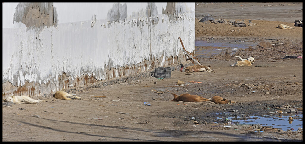
Town dogs catch early rays before starting their day.
Birders flock to preserved marshes north of town. The drive out to the marshes is on some bone-jarring dirt roads, but worth it.
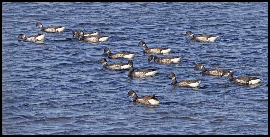
Flocks of Brandt Geese were new to me.
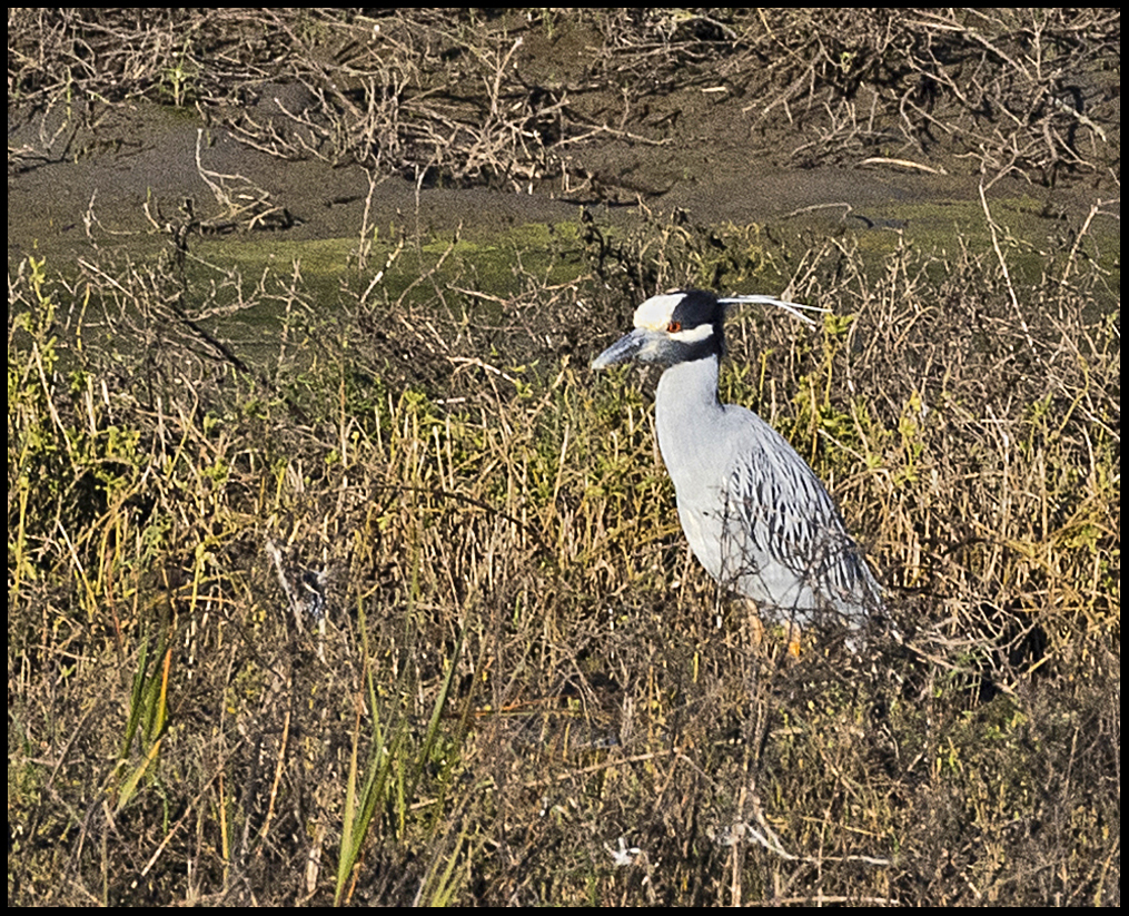
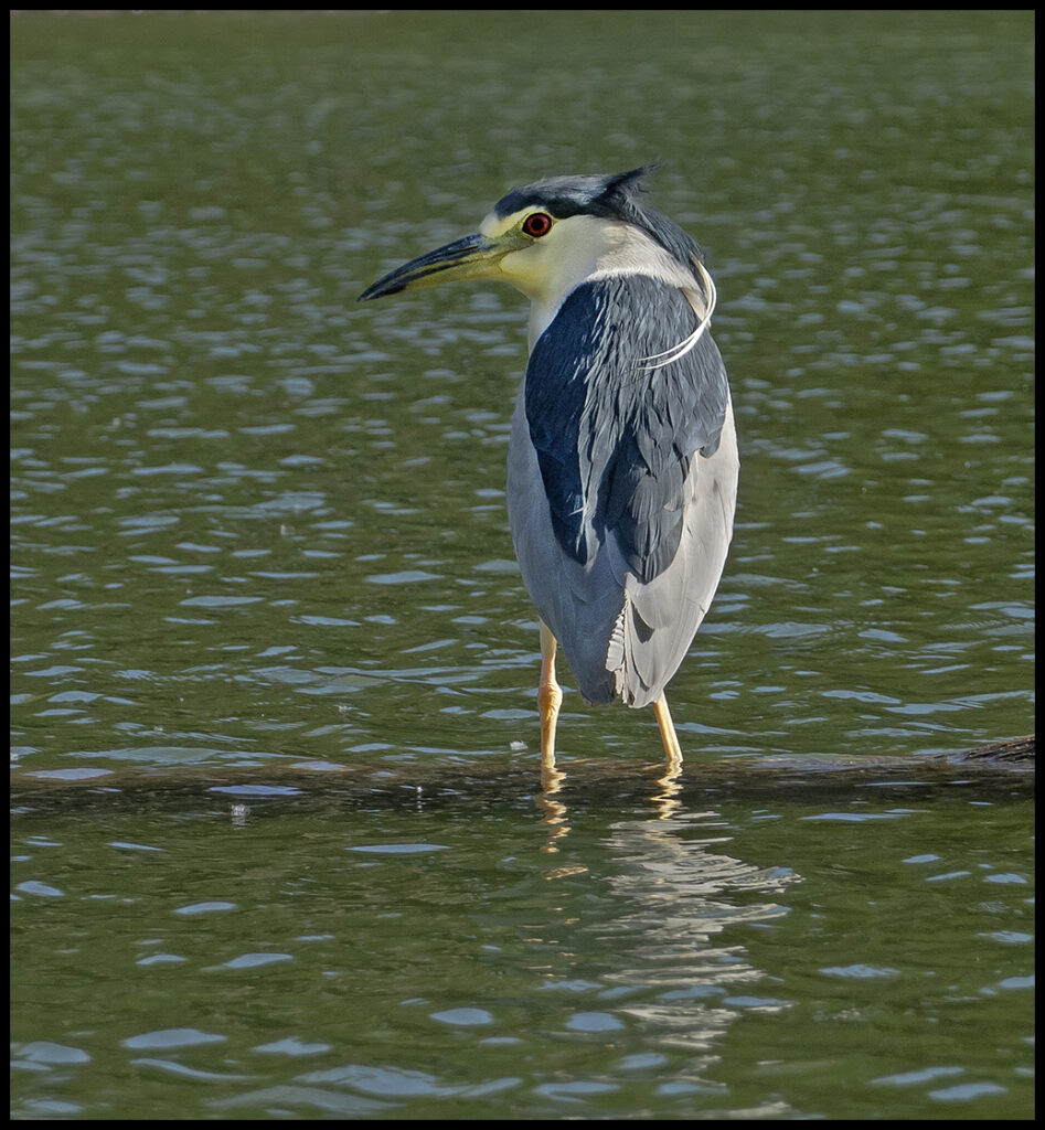
There were 14 Yellow-crowned night herons congregating in one watery stretch
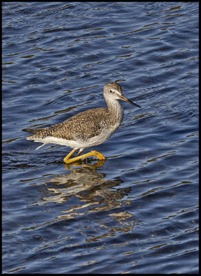
Lesser Yellowlegs
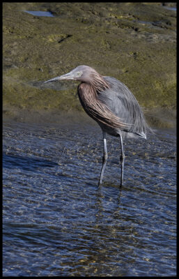
Reddish egret
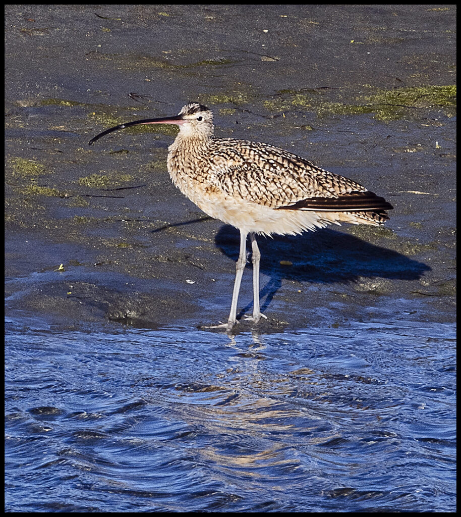
Many Long-billed curlews spend winters here.
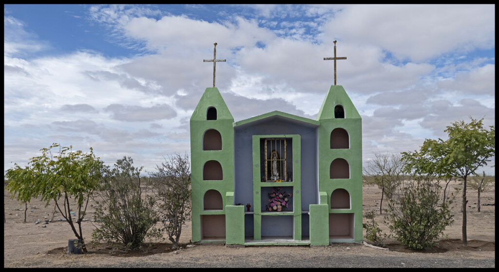
Leaving Guerrero Negro, at the junction with Hwy 1, lies this captivating shrine with a chapel next to it (not shown).
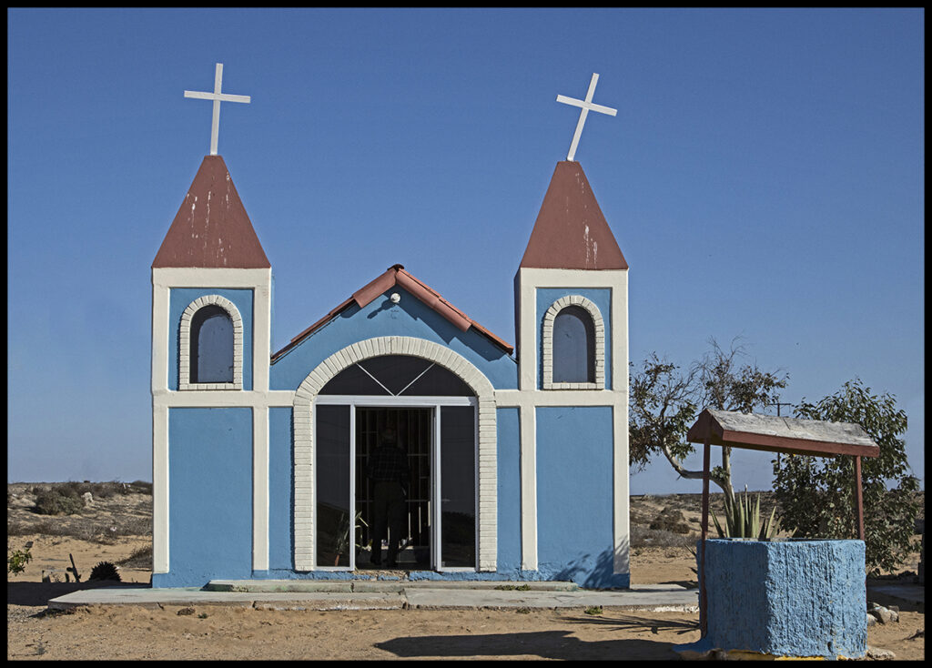
Shrine at the junction
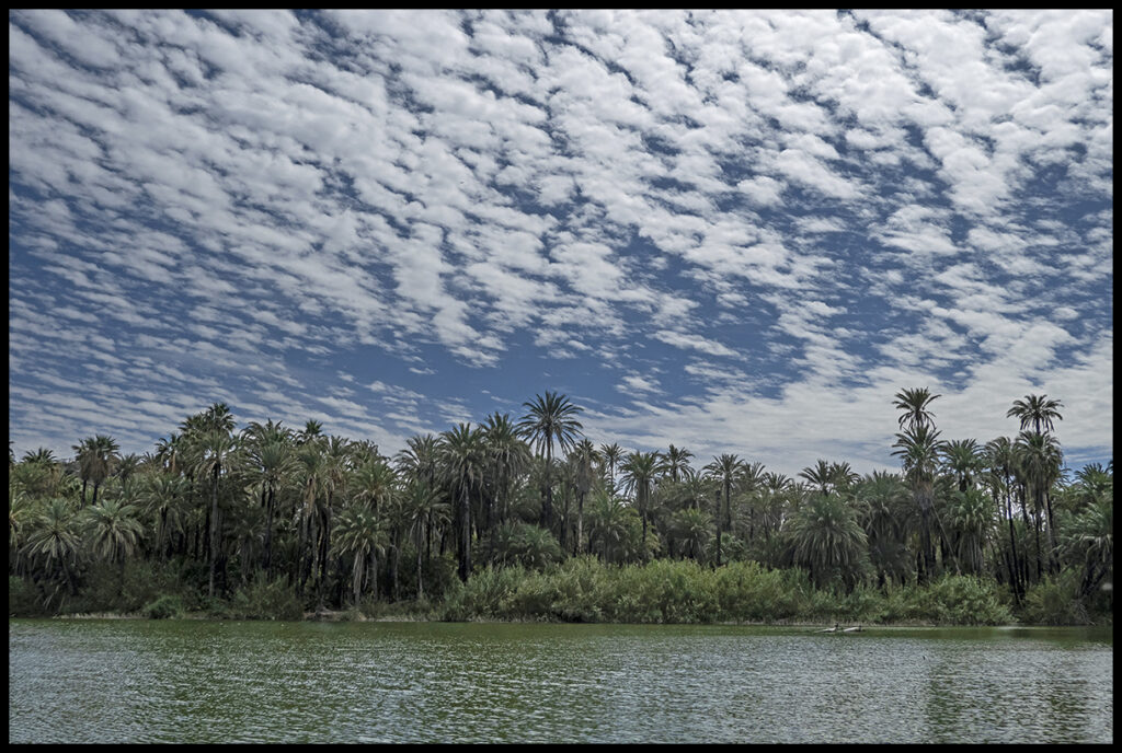
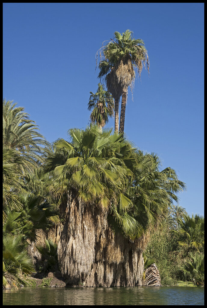
Halfway across the peninsula is the small town of San Ignacio, a date palm oasis in the dry desert. A river comes to the surface there and forms a lovely lagoon in town. The town itself is a captivating bit of old Spain. Spanish missionaries recognized the unique possibilities of such a place and set up shop in the 1700’s.
About 36 miles from the town is the San Ignacio Lagoon on the ocean. It’s one of the other bays where Pacific gray whales breed. About 8 miles south of town is a shop on the top of a hill just off the highway. A lady there sells dates by the bag and the best date bread you’ll ever taste.
We stay at a nice little RV park close to town so we can walk in. These are the birds I always see around the camper.
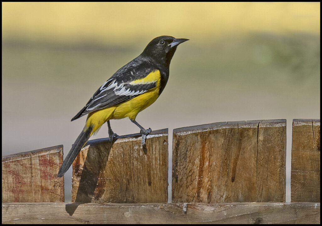
Scott’s oriole
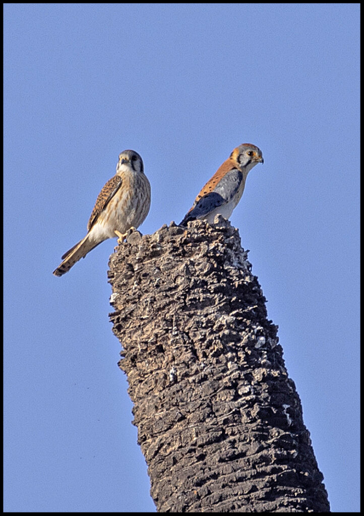
A pair of American Kestrals on a dead date palm snag
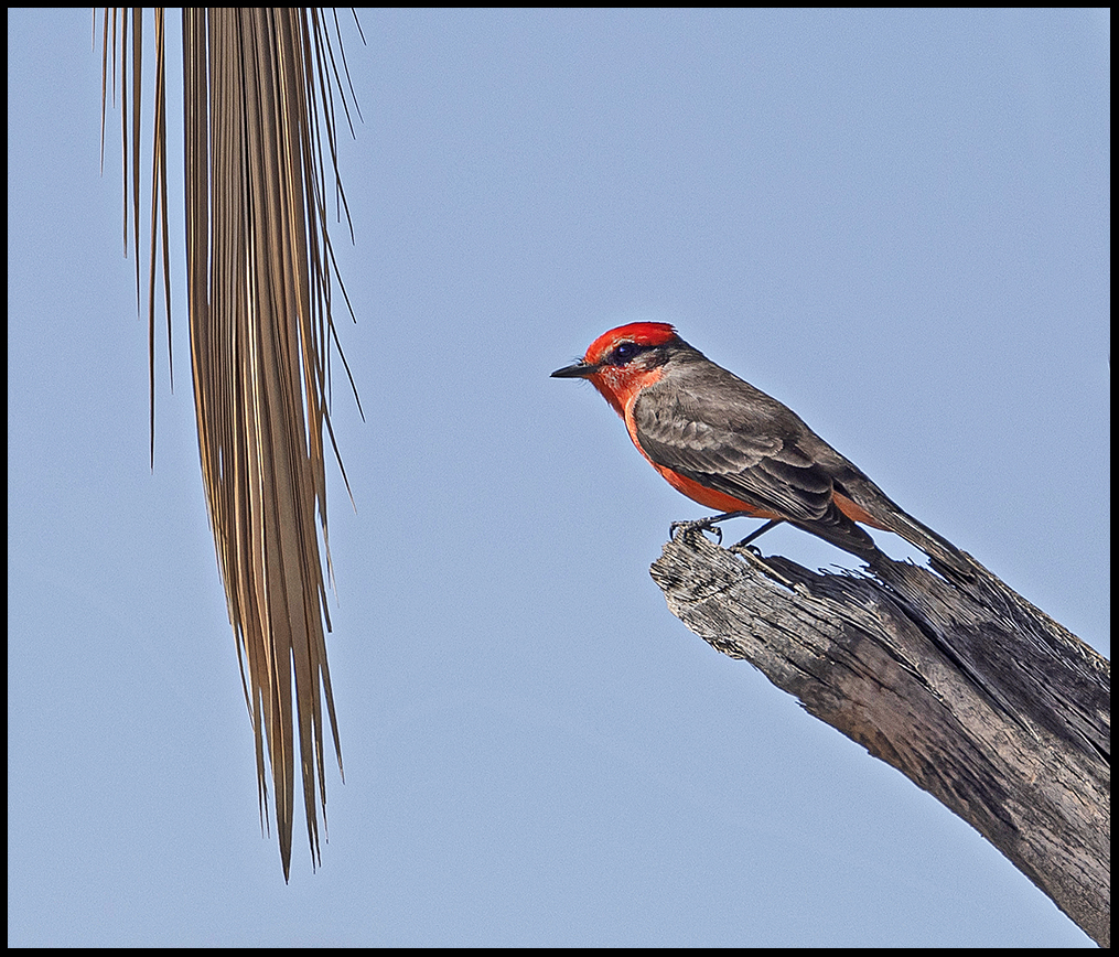
Vermilion flycatcher
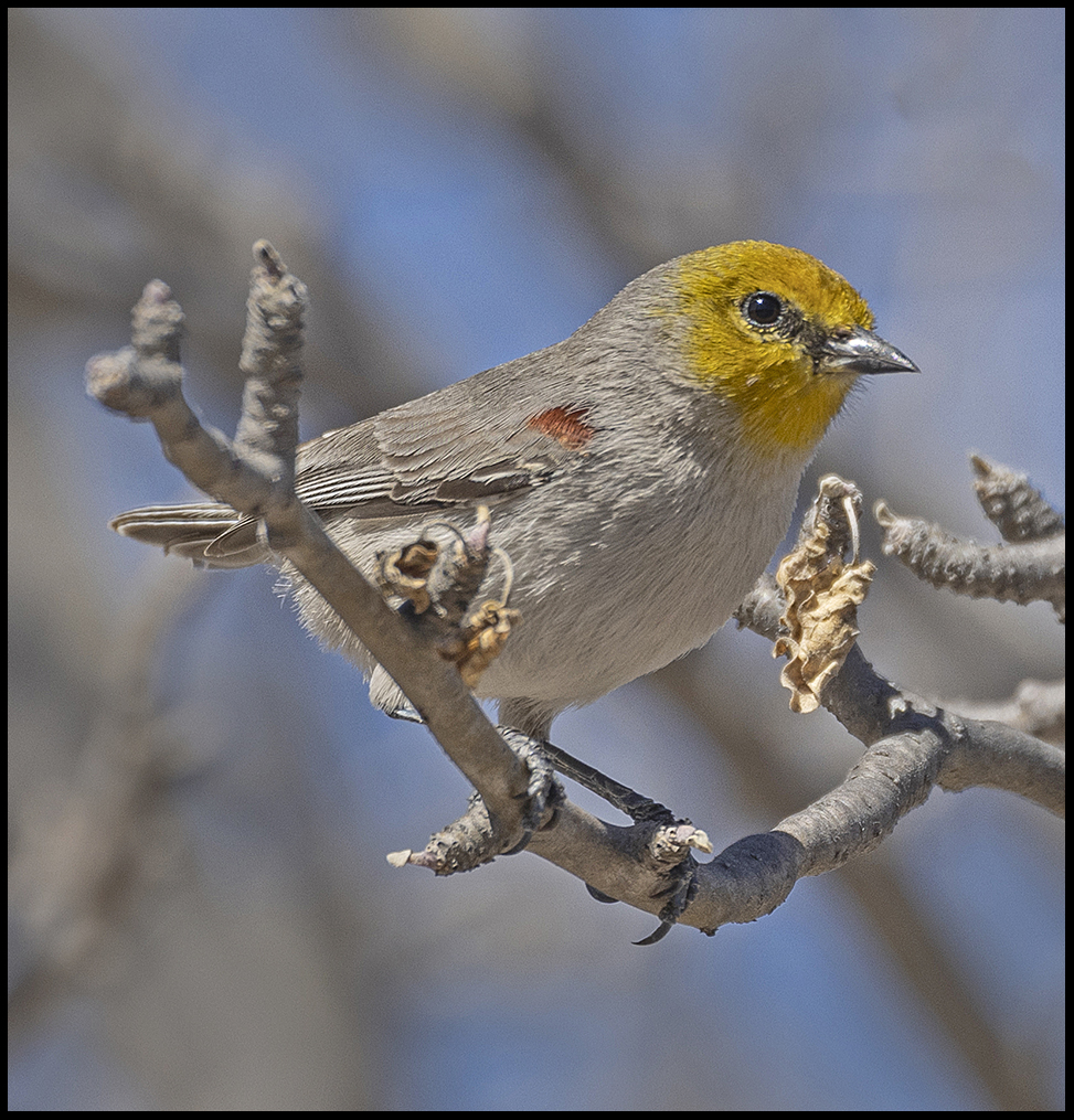
Verdin
The verdin pair was very busy building their nest. So busy, my snooping didn’t seem to bother them. When we came back through a few weeks later the nest was finished and she was probably inside sitting on eggs. Not a verdin to be seen.
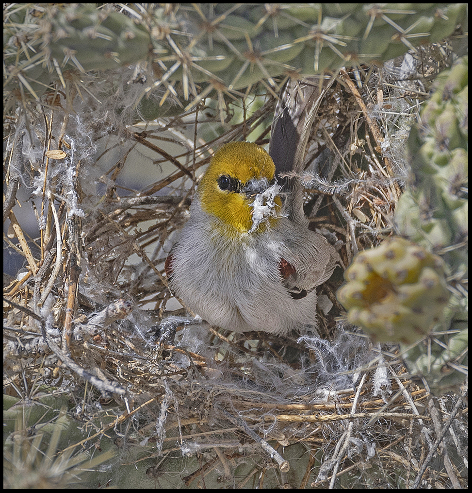
Mr. Verdin fusses with the nest construction
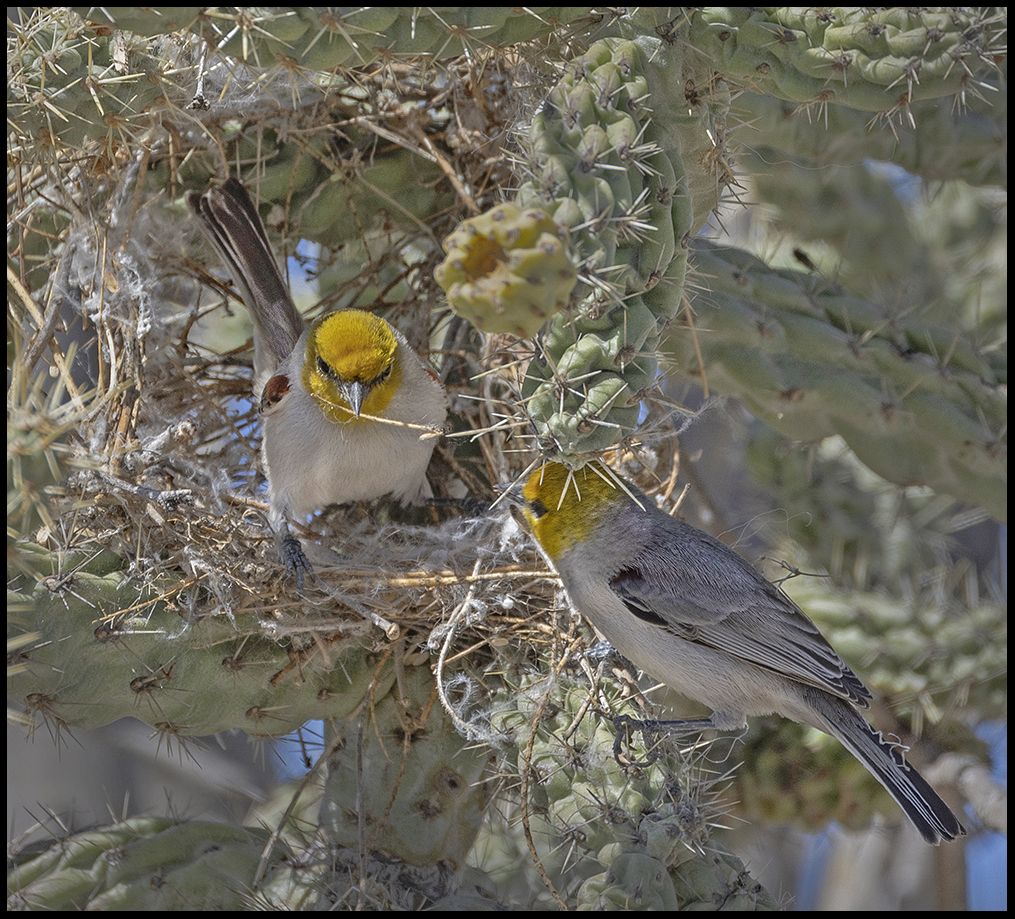
Mrs. Verdin supervises
We took the kayak down to the town lagoon. There’s about a mile of water to the end.
I just finished saying that we’d not seen a single night heron this year, when this Black-crowned youngster peered out at us from the bank.
Later an adult Black-crowned night heron let us paddle right up to him.
Nearing the end of the lagoon.
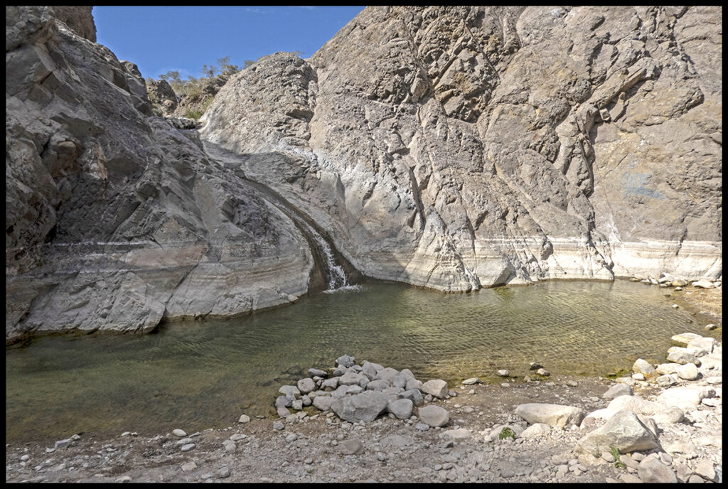
Southeast of San Ignacio is the big town of Santa Rosalía on the gulf side. The ferry to mainland Mexico leaves from here. It’s a good place to stock up on groceries and eat some fish tacos. Before reaching the town, we turned off on a side canyon for lunch.
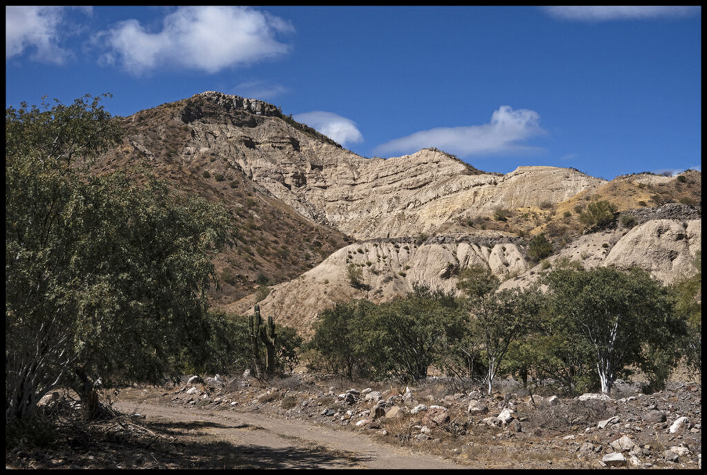
Side canyon near Santa Rosalía where we stopped for a picnic.
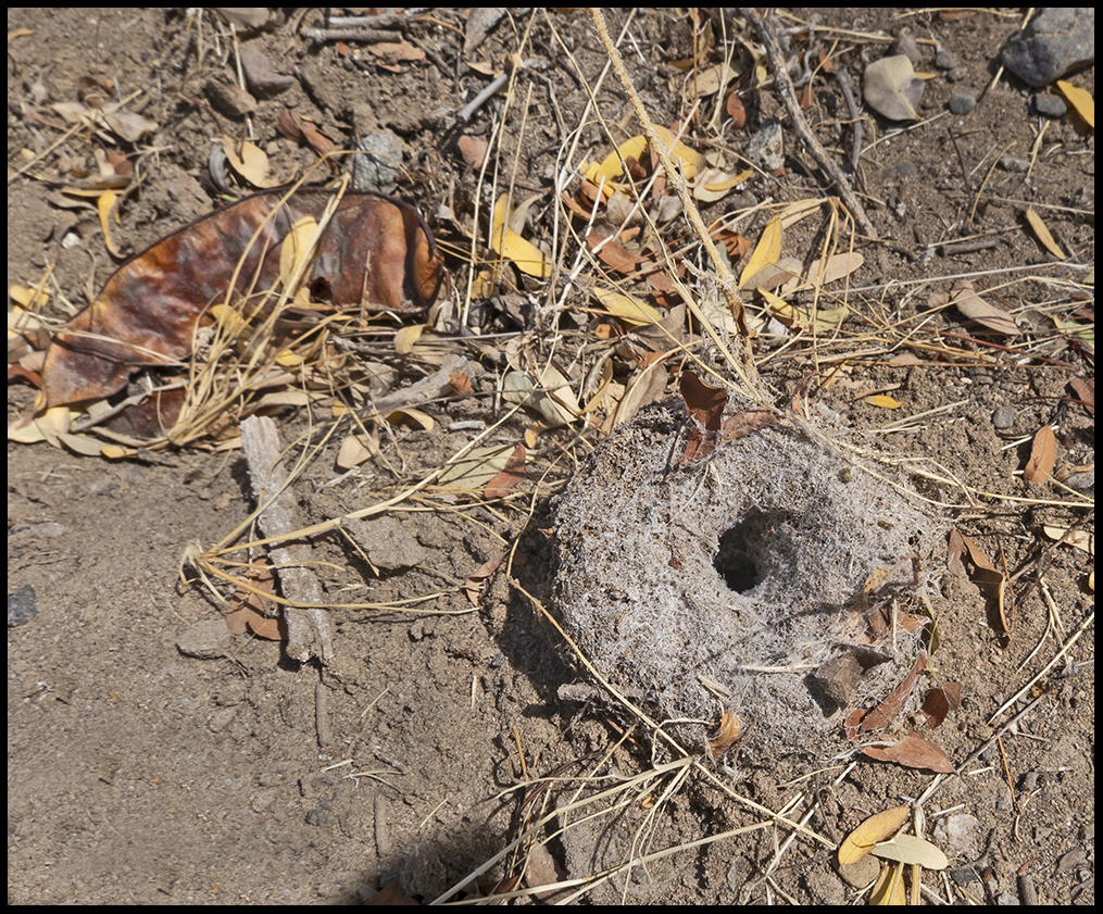
At the lunch spot was this cunning construction by some sort of critter.
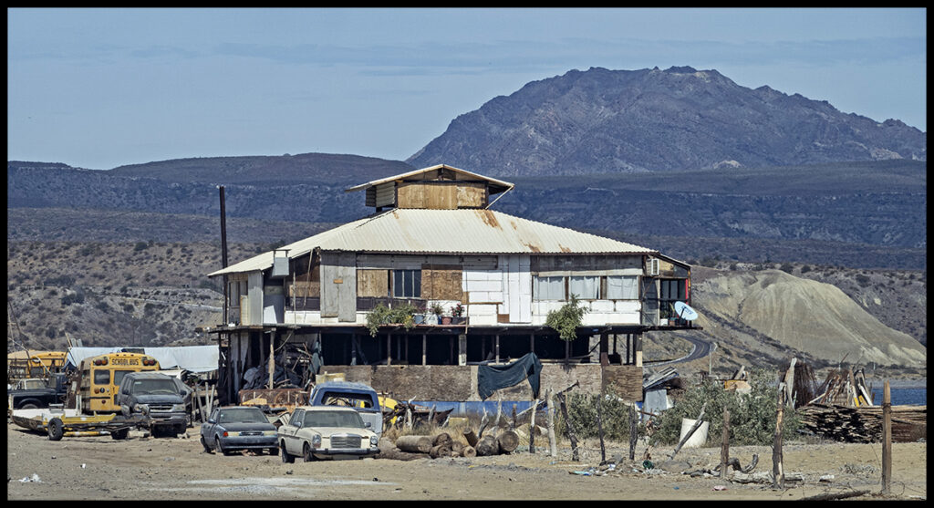
Entering the town of Santa Rosalía is Craig’s favorite hovel. It does have beach frontage.
Stop at Mulege, another oasis town with a fresh water river running through. In the open square are several stands selling yummy food.
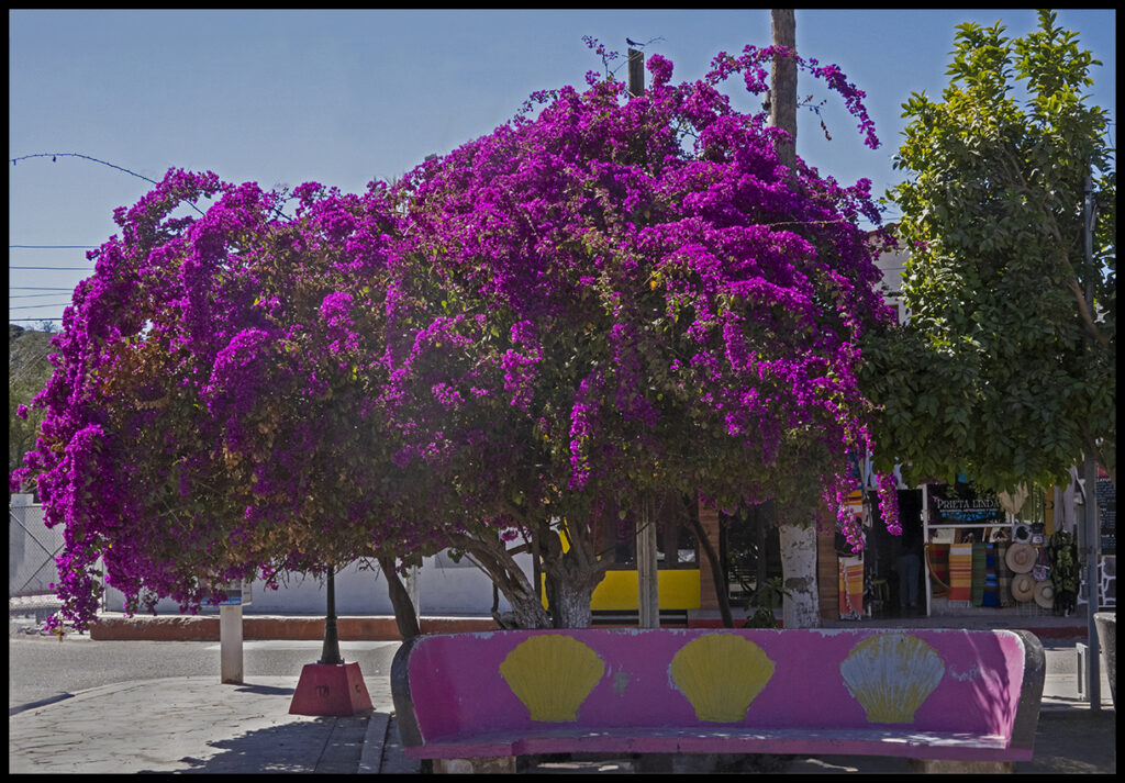
Large bougainvillea in Mulege’s colorful square
The RV camps south of Mulege along the Bahía Concepción were chock-a-block with tourists so we escaped to the south end of the bay where few people go. The beach is rocky and barren…not the sort tourists seek out.
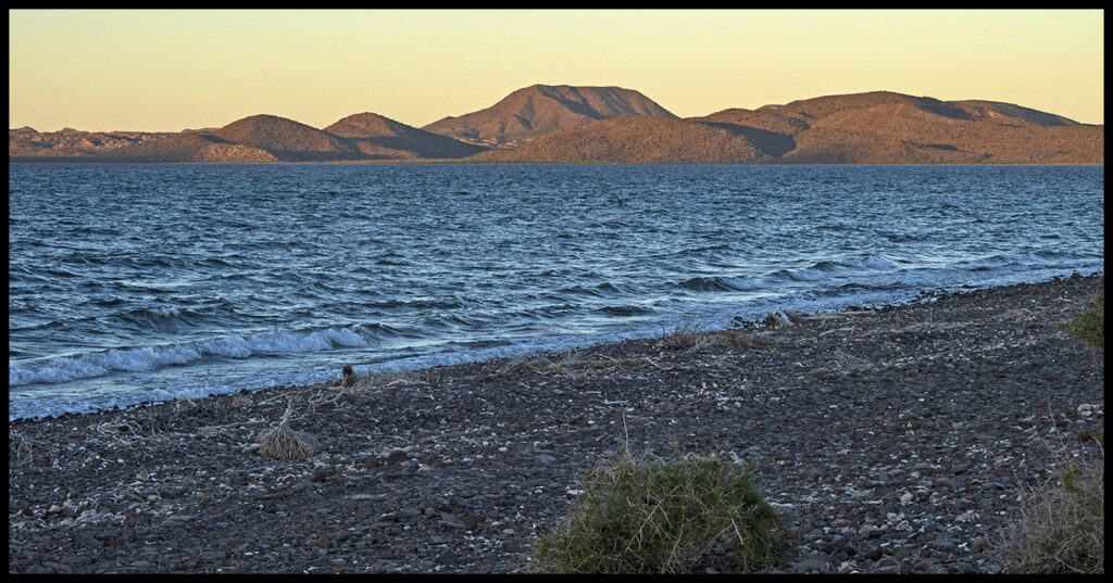
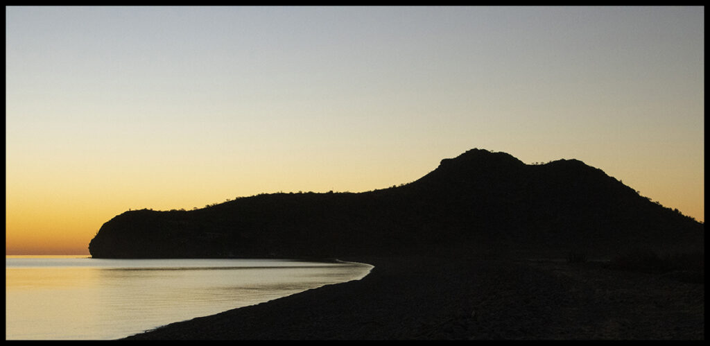
End of the bay at sundown. The outer peninsula is on the far side.
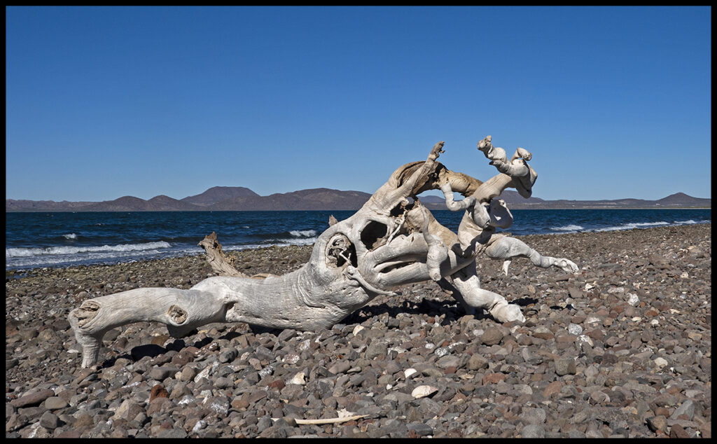
Driftwood washed ashore
Swimming hole with warmer water.
In the 70’s after Highway 1 was paved to that point, apparently there were hundreds of pangeros “mining” scallops in the bay. The bay was lined with man-camps in tarp shelters. There they shucked the scallops and loaded them on to Japanese ships for processing and shipping. When the bay was nearly stripped of all scallops, the Mexican government finally banned scallop harvesting except for one month a year. I don’t know how the scallops are faring now.
The shells were piled in huge middens in the nearby desert and are still there today. Many piles have been hauled out to crush and use in landscaping projects.
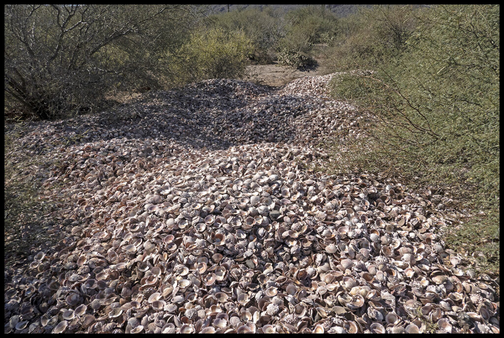
One of many huge piles of scallop shells.
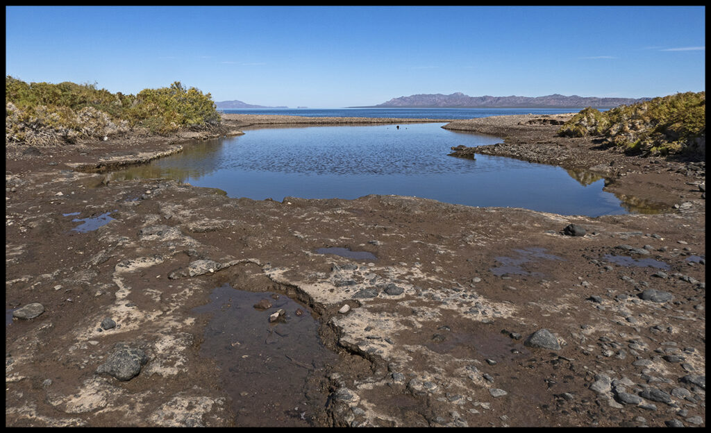
We’d planned to camp next at a spot along the road to San Javiar outside of the lovely town of Loreto…but it was not to be. The road in was very rough after the hurricane and when we got close to the site, we had to hike in. The campsite is gone. Huge rocks litter our favorite little box canyon. The pool is still there, but driving in is impossible.
End of the box canyon.
So forced to rethink, we made a dash for another favorite area on the coast just short of the little fishing village of Agua Verde. On the way in the road goes by a spot called “the last water” and other desert scenes.
Agua Ultima, The last water.
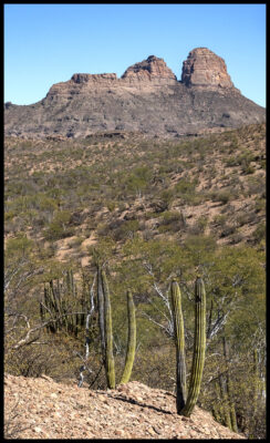
Desert scenery
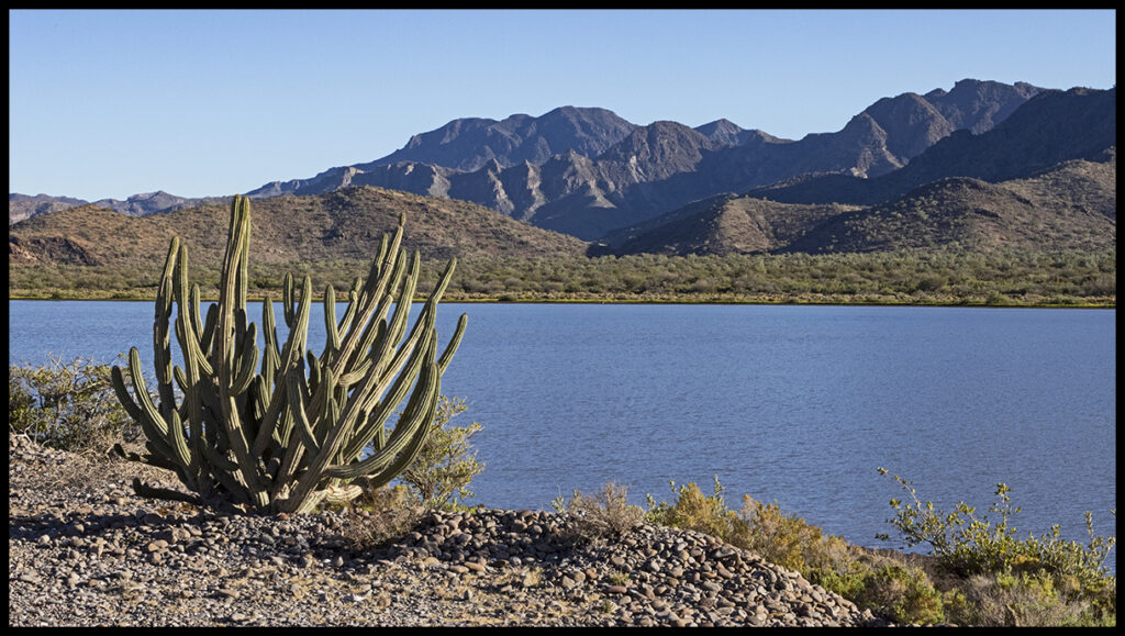
Perhaps you can see the lagoon we like to camp by. There is a small RV park, called Rancho San Cosme, at the bottom of the hill, but we like to continue to our little rocky beach closer to the lagoon.
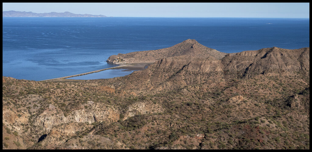
Lagoon destination. There is a resort on the southern tip, but we go to the near end.
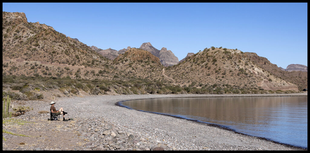
No one ever bothers us on this beach.
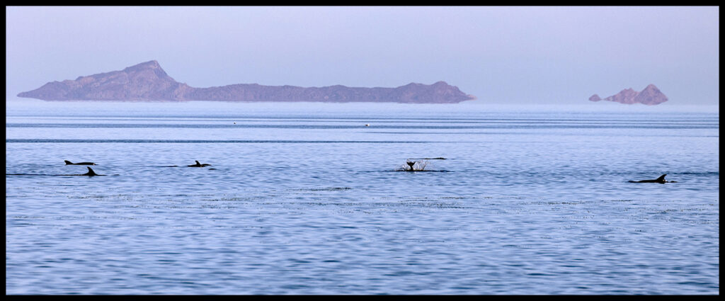
During the day large dolphins passed by.
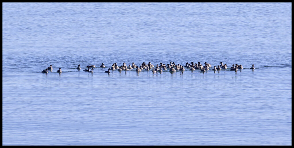
Rafts of grebes float along the gulf coast.
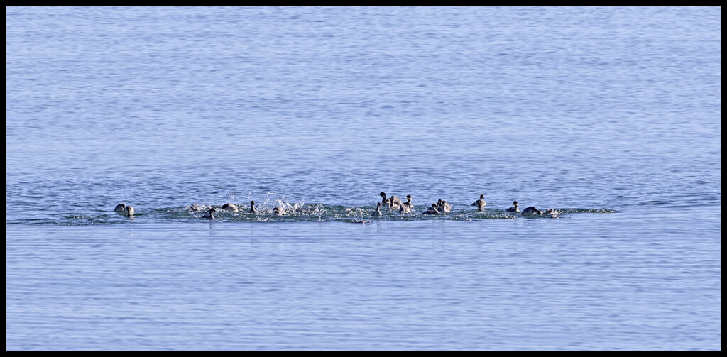
They all dive as one and then resurface to reform the raft.
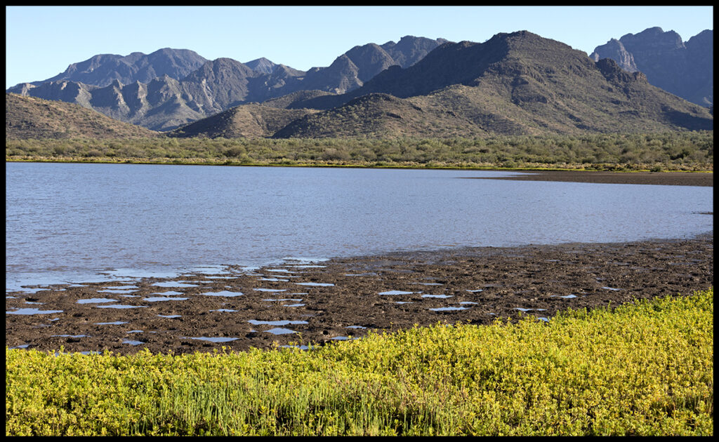
The lagoon is large and the tides don’t seem to affect it.
Other end of the lagoon.
Sunset behind what I call alligator head. The sleepy resort is on the tip of the nose.
The water was calm and we did snorkel but I forgot to take the little underwater camera. Too bad, as the puffer fish and rock gardens were spectacular. Alas, next time.
On the way to La Paz we always stop at a little stand in the agricultural, central city of Ciudad Insurgentes for fish tacos.
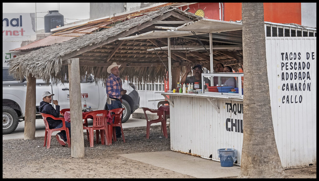
Taco stand in Insurgentes
I’ll close out this chapter with a little local color. Along the highway are hundreds of shrines to people who have died at that spot. The highway is dangerous to drive at night or at high speeds as the shoulders are narrow to non-existent, and potholes abound. There are fancy shrines and very modest ones.
An example of a fancy shrine, with well kept trees planted next to it.
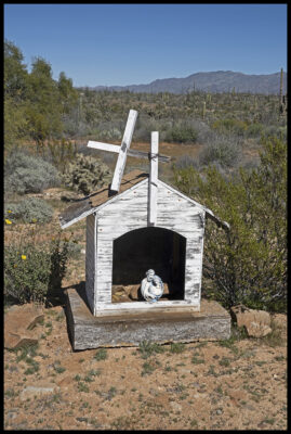
More modest shrine.
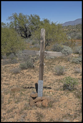
The most modest of all.