

Hillside stripes with Gambel Oak (aka Scrub Oak) dominating
With a bit more time, we range further south. This part of the state is renowned for fall foliage. The Million Dollar highway from Silverton to Ouray (Hwy. 550) is the most famous, and rightfully so. The high altitude views are spectacular. However, it’s also the most crowded during peak leaf viewing…so of course, we avoid it.
After getting over Trail Ridge Road in Rocky Mountain Park turn left to Granby, follow the previous portion of the tour until you get to Eagle, then leave the tourists behind and head for Sylvan Lake State Park on the paved Brush Creek Road (Forest Road 400). Continue on the dirt road beyond the state park to Crooked Creek Pass and Reservoir and shortly after, Lime Creek Canyon. Camping is available all over as it’s BLM public land. We turned off FR400 for a few hundred yards to camp near the canyon just off FR 507. The views are amazing.
Leafing routes mentioned

Old barn at Sylvan Lake St. Park
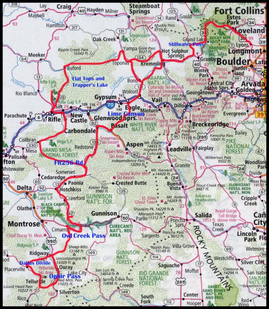
Crooked Creek Reservoir
Lime canyon from our campsite. Climbers are drawn to the canyon walls.

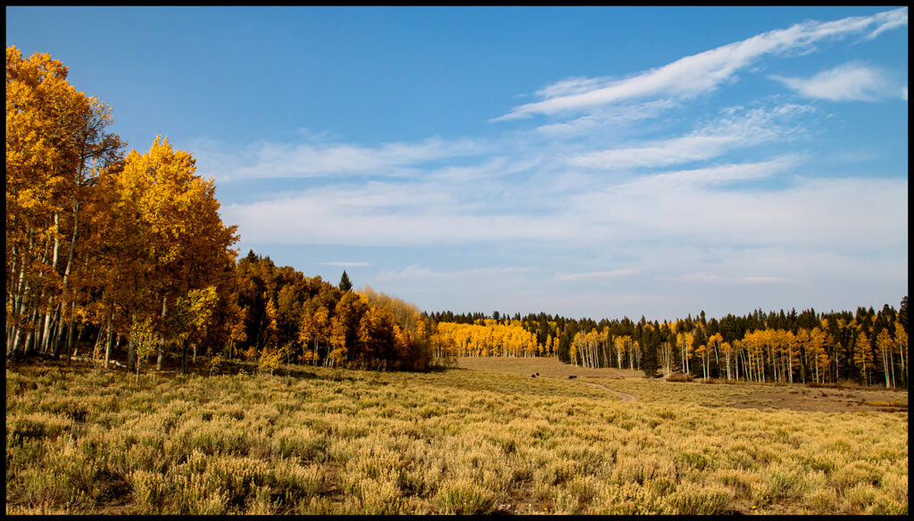
Morning light slowly illuminates the glowing aspens.

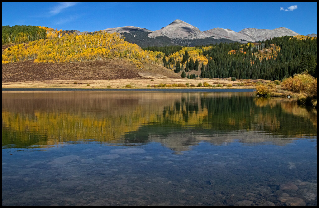
View across Lime Canyon to FR400 which eventually emerges at Thomasville on the Frying Pan River Road. The road passes Reudi Reservoir on the way to Basalt.
From Basalt to Carbondale, over McClure Pass to Hotchkiss and then Crawford. If you’ve never been to Crawford, it’s a cute little town. My favorite rocker of the day, Joe Cocker, chose this little burg over jolly old England to live out his days. I think his widow still lives there. The north side of the Black Canyon of the Gunnison National Park is the quieter side. Views of the canyon are worth the drive in. If the campground is full, or if you want a more private spot, turn west off the dirt road before the park for dispersed camping on BLM land. Retrace your steps back to Hwy. 92 to continue south.

Weird lichen lumps.

The Gunnison River carves a 2722′ deep and scenic canyon through Precambrian Rock.

Stripes on the canyon wall.
Dispersed campsite view.

View back towards Crawford.
We decided to camp off Hwy. 92 before leaving the area. I think we took the 720 Road along the Curecanti Creek, but I’m not quite sure. I forgot to write it down. There are a number of roads leaving 92 to the east and I imagine all have camping opportunities. We found a lovely spot off the main road in a clump of aspens.
Valley we found to camp in.
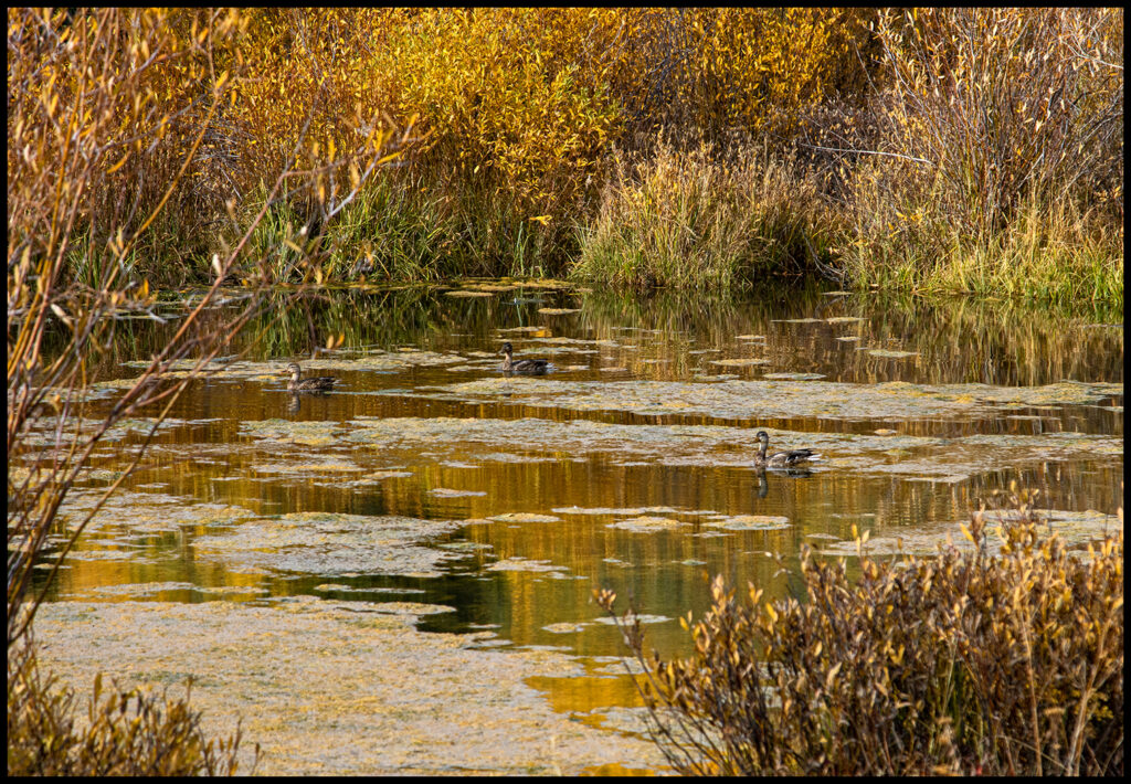
Beaver pond with migrating ducks.

Pine Grosbeaks heading south or maybe staying…their choice.
Aspen with claw marks.
If you think you can climb your way to safety when a bear is chasing you….think again!
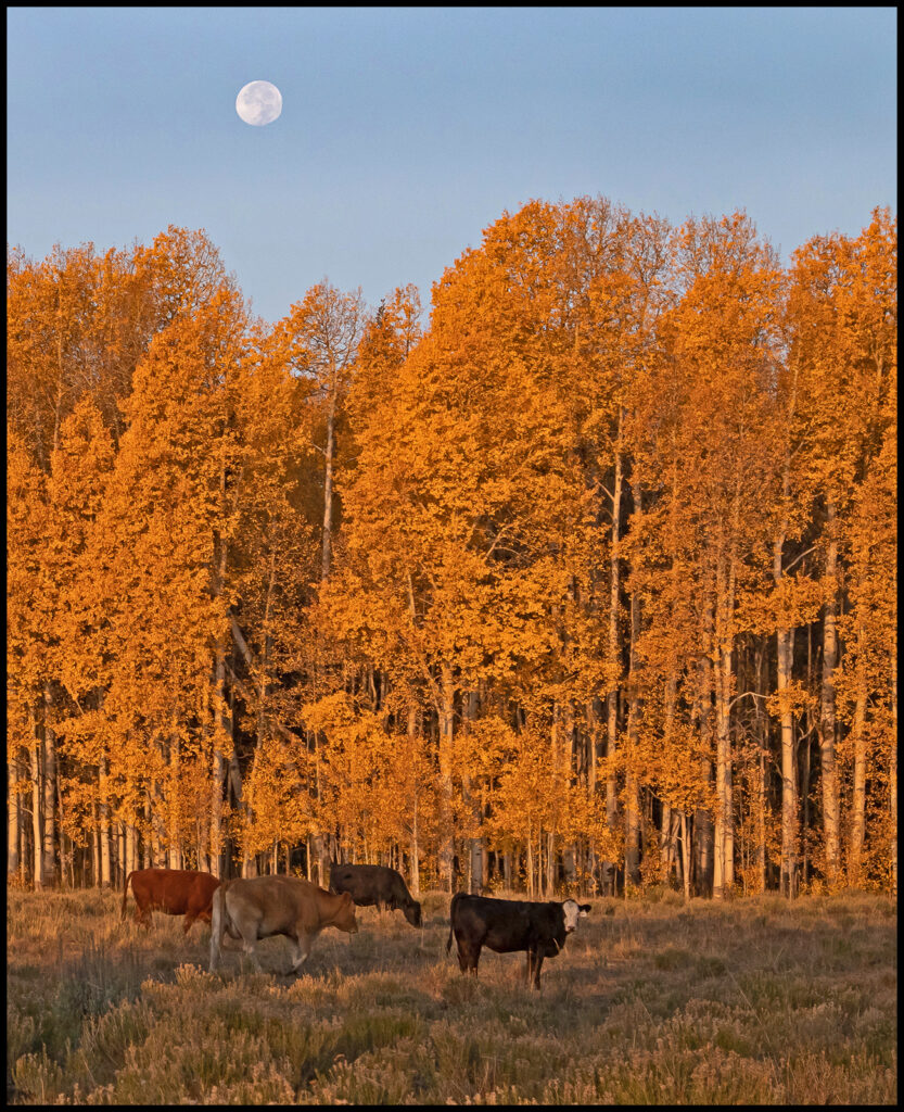
Tranquil morning view from camp with curious visitors.

Can’t remember where we saw this old barn. The elk picture is used for cowboy target practice. Some of them are obviously bad shots.
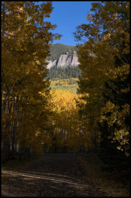
Where 92 dead ends into Hwy. 50, take a right to Cimarron. Go south on Owl Creek Pass to Ridgeway. Owl Creek is better known than FR256 (from the previous blog post), but it’s still not too crazy and it does have some terrific leaf viewing. Camping is available in FS campgrounds on the pass or at Ridgeway State Park four miles north of Ridgeway.

Lake at the bottom of the pass.
Campground view.

Road is dirt, but well maintained.
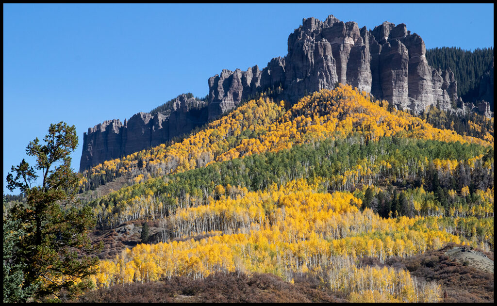
Cliffs of limestone and tuff follow the road.

Aspen leaves.

Light and shadow play on the cliffs.
Ridgeway is a trendy little mountain town. From here you need to make a decision. If you go west over the Dallas Divide and down to Telluride, it’s a very scenic drive. However, unless you want to go all the way to Durango and back up through Silverton/Ouray on that Million Dollar Hwy., you’ll need to drive over Ophir Pass or retrace your steps.
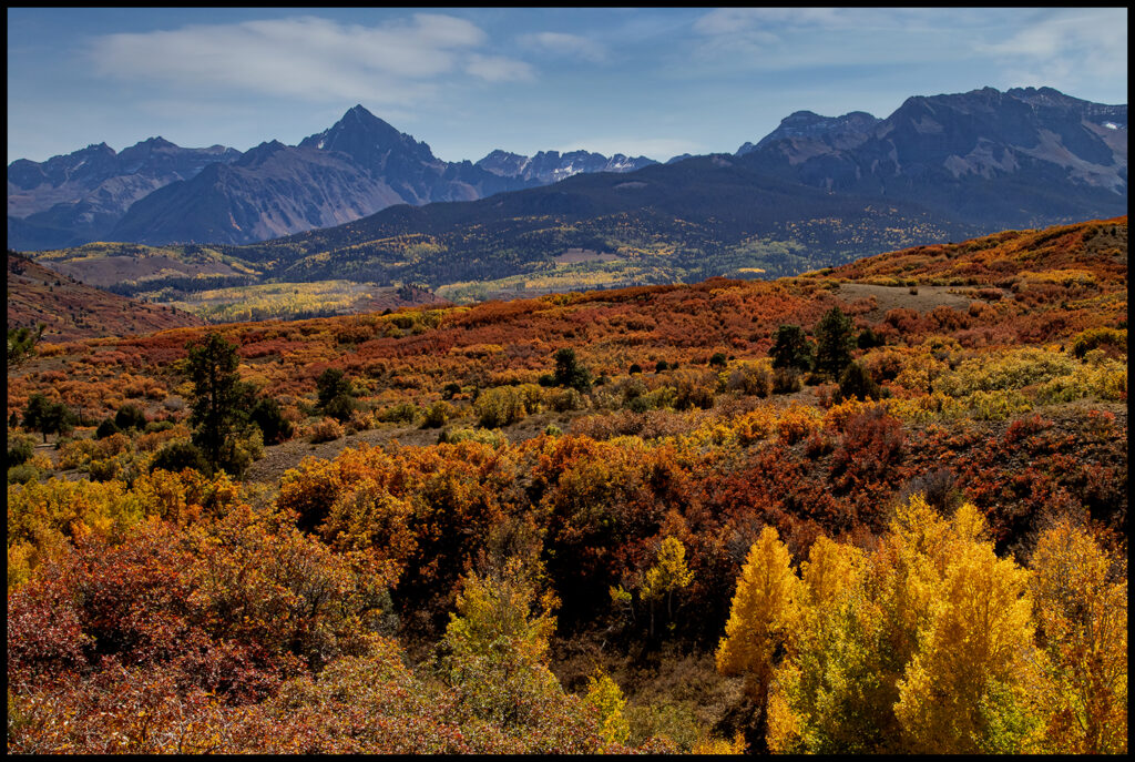
Dallas Divide has a scenic overlook pull out.
This part of the state was/is a huge mining area. There are mining claims crisscrossing all over the map for hundreds of miles. Telluride itself is a Victorian gem founded in 1878 after gold was discovered nearby in 1875. It nestles into an eye-poppingly splendid box canyon surrounded by steep forested mountains. It’s now one of the most expensive pieces of real estate in Colorado, rivaling Aspen.
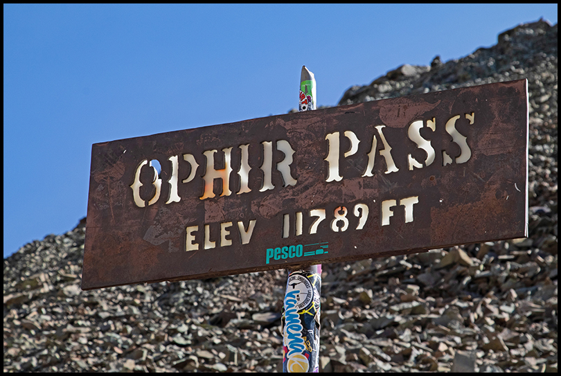
Thirty years ago, after attending a mushroom festival there, I crossed Ophir pass by myself driving my old ’76 4Runner. The road on the west side is now in worse shape. Scree avalanches of rough rock make for slow, careful going. The east side is well maintained, so if you’ve got a good 4WD and an adventurous spirit, give it a go. If you decide to take the long route around, there are many Forest Service campgrounds along the highway to Durango.

Looking at Ophir Pass from the bottom west side.

Nearing the pass, the west side doesn’t look too bad.


Looking east from the top.
Colorful rock stripes add interest above treeline.

At a campsite we found. Unfortunately miners left the water courses heavily polluted. I doubt there are plans to clean any of it up. I hope I’m wrong.
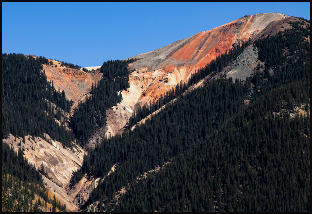
The unusual mountain top colors in this part of the state.
We chose to return over Owl Creek Pass. It’s interesting… going a different direction at a different time of day…it looks different, like you’re on a different pass. I’ll include a few roadside photos of the drive home before signing off until the next time. Thanks for riding along.
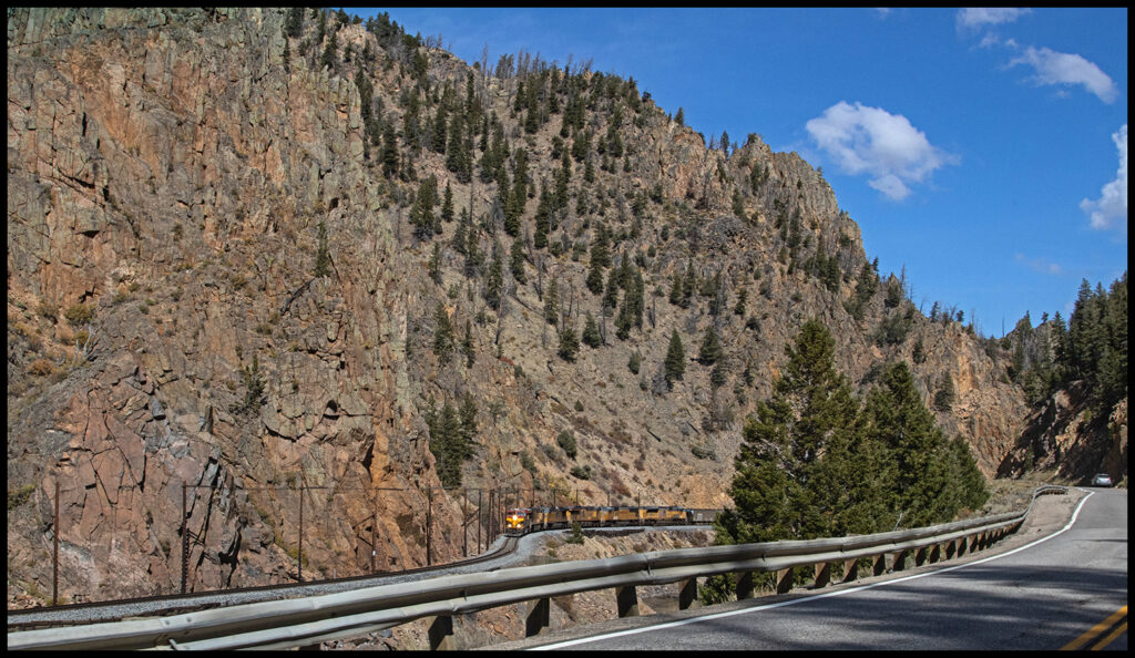
Byers Canyon near Hot Sulphur Springs with the train coming through.

Tranquil scene east of Hot Sulphur Springs. The continental divide in the distance.

Near Grand Lake on the west side of Rocky Mountain Park. It’s obvious we are in a drought. The Colorado River was the lowest and warmest ever in 2021. Trout aren’t the only fauna suffering. We hope for rain or snow soon.

Wild geranium leaves.