
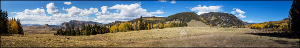
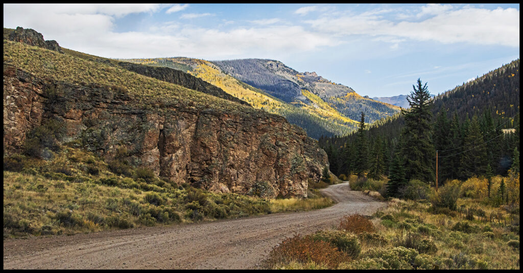
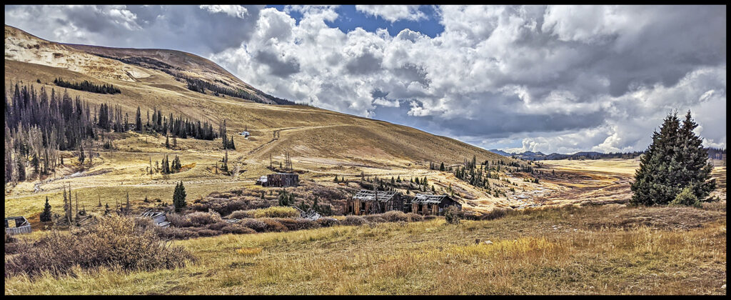
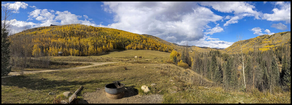
Panoramic view from our campsite south of Creede on FR526.
Pick a week at the end of September, early October and you should find glorious colors in the Colorado mountains…just about anywhere. The reason I write these blogs is to showcase beautiful places on the planet I’ve been fortunate to visit, to provide some interesting background about these places and to encourage others to go see them for themselves. We try to pick less crowded areas and find wilderness camping on forest service land or in forest service campgrounds.
Starting from Lyons we made a beeline for Highway285 through the north end of South Park. It was getting late so we ducked off the highway on Lost Park Rd., the first left turn at the bottom of Kenosha Pass. Plenty of dispersed camping available. This road dead ends at the Lost Creek Wilderness area…an adventure for another time as we woke to a very flat tire.
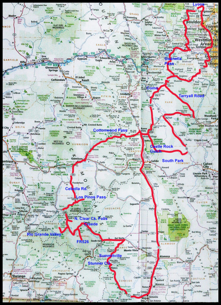
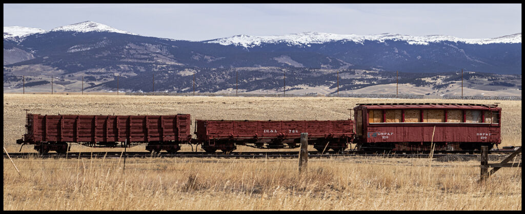
Took a half mile detour to visit Como on the way to Buena Vista to buy a new tire. Como was a major railroad junction during the mining era of the late 1800’s. It reached its peak in 1910, supporting hundreds of workers in the roundhouse and machine shops as well as the town businesses. Tracks led to Denver, Leadville/Breckinridge, and Gunnison. In 1938 the last train left Como, pulling up the rail as it went. The stone roundhouse, a national historic building, is being slowly restored. Not quite a ghost town; there are about 20 residents, a post office and a couple of occasionally operating businesses. (These pictures were taken on a previous spring trip, thus the snow and barren aspens.)

Main streets in old west towns are very wide to accommodate turning stagecoaches and their teams of horses.
Colorful residence.
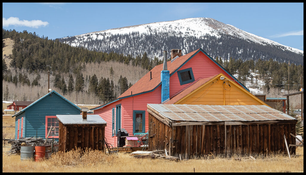
Sign of a bygone era.
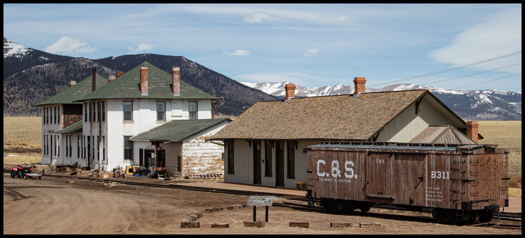
The Como hotel and train depot.
Cars in various stages of restoration.
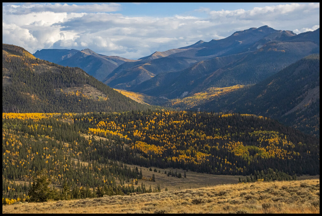
From Buena Vista it’s worth the drive over Cottonwood Pass (12,126’). It’s now paved all the way. Exit near Gunnison, a good place to stock up on all the things you (we) forgot to bring. Follow Hwy. 50 west until the Lake City exit on Hwy. 149. Leave 149 at Powderhorn and drive the good dirt Cebolla Road as it loops around and rejoins 149 south of Slumgullion Pass. We found a beautiful campsite just below Los Pinos Pass.
Long view from our campsite just before Los Pinos Pass.
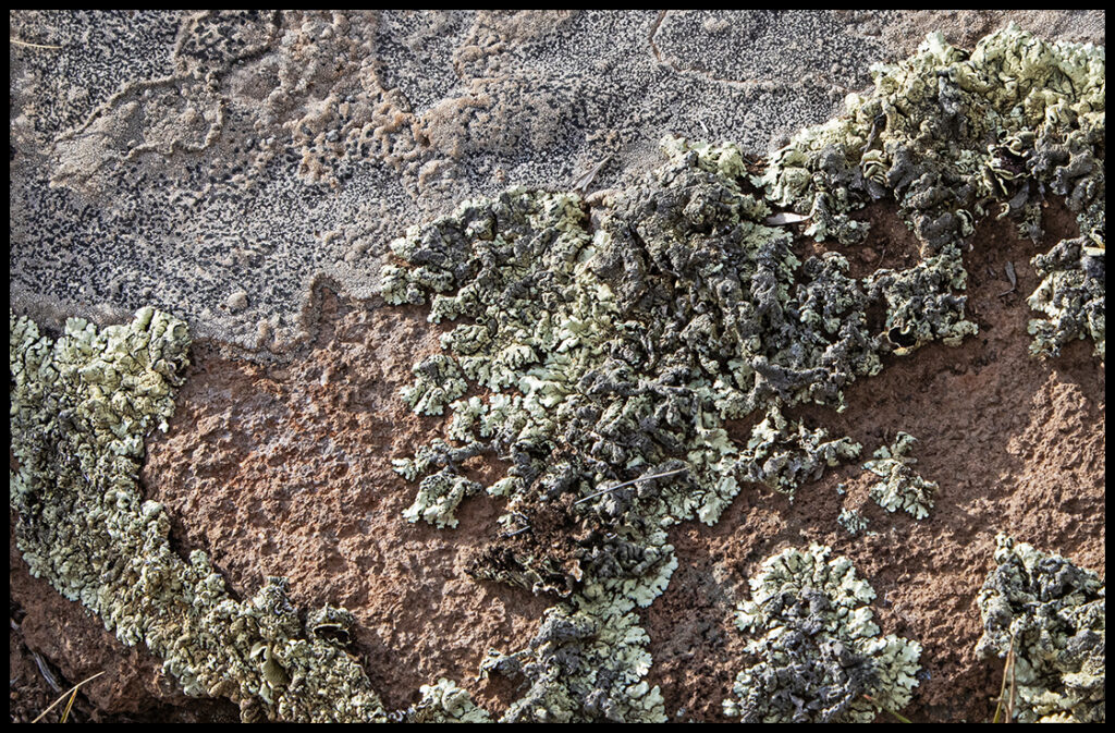
Up-close view of Los Pinos lichens.
However, in the morning we realized we had overshot the Cebolla road turnoff and were lost. We drove back and took what we thought was the right road only to end up in the front yard of Brad and Annette Cadwell who run the spectacularly gorgeous Cathedral Ranch. They have 7 cabins they rent out, so I’m including a link at the bottom of the post to their website in case anyone is looking for a great getaway location.
Cebolla Road
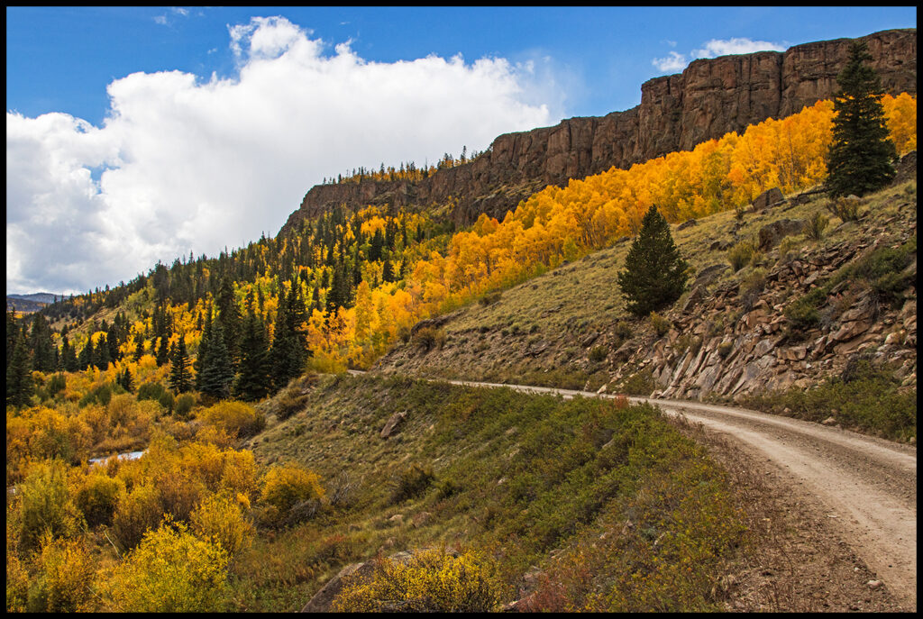
The colors were at their height.
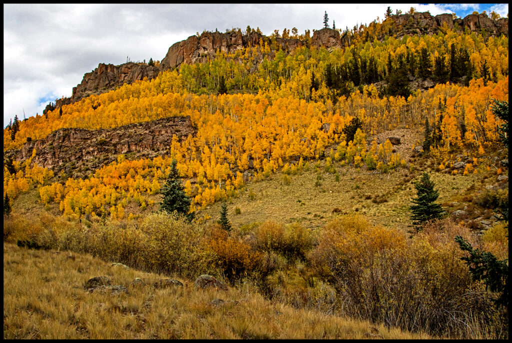
We took a hike on a marked trail off Cebolla Road near the 149 junction.
Once back on 149, shortly after crossing Spring Creek Pass, take a quick peek at N. Clear Creek Falls, just a few hundred yards off the highway. The falls plunge more than 100’ off a rock shelf formed from ash flows from an enormous volcanic eruption around 27 million years ago. The Oligocene Period was tectonically active, helping to create the San Juan mountains. The town of Creede now sits in the bottom of what was a giant water-filled crater.
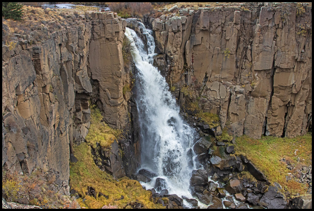
North Clear Creek Falls
I’ve had the Rio Grande River headwaters on my bucket list forever, and finally got to go there. It’s a beautiful valley but the weather was threatening. We found a dead-end side road and a nice campsite with huge aspens. On the way out the next day two moose sauntered across the road in front of us, but I was too slow grabbing the camera.
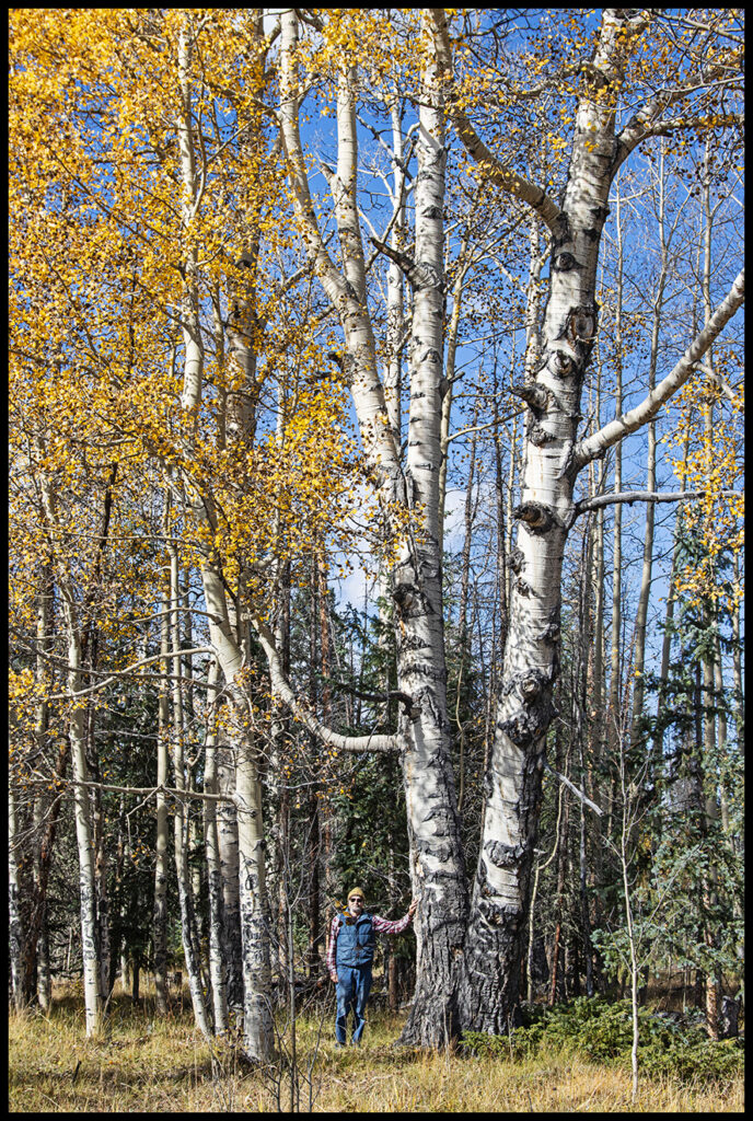
Craig with giant aspens.
Sadly much of the national forest land in this part of the state has been hit hard by the spruce budworm. The pests have decimated the Engelmann Spruce. The feds are trying to sell off timber lots to loggers who will come in and salvage the deadwood. Apparently the sales aren’t going well, as millions of acres of standing dead trees are visible. One fortunate thing is the budworm doesn’t seem to infect the Colorado Spruce or the firs, and they are flourishing.
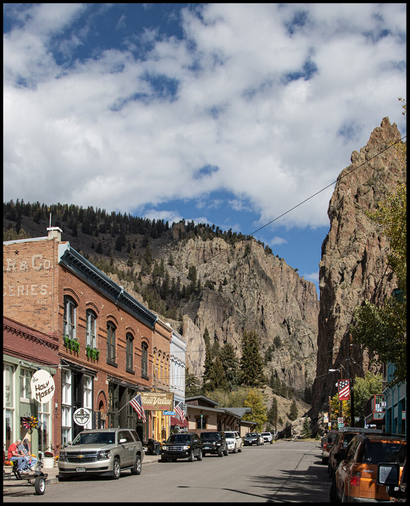
Creede, CO
The town of Creede has a rowdy past. Ranchers and homesteaders moved in in the 1870s when stagecoach stations linking the mining operations over the Divide from the east were built. The boom days began in 1889 with the discovery of gold, silver, lead, zinc and copper. The town leapt from a population of 600 in 1889 to more than 10,000 in December 1891. The resident population now is under 300. The Creede mines operated continuously from 1890 until 1985. Creede was the last boom town in Colorado to close its mines.
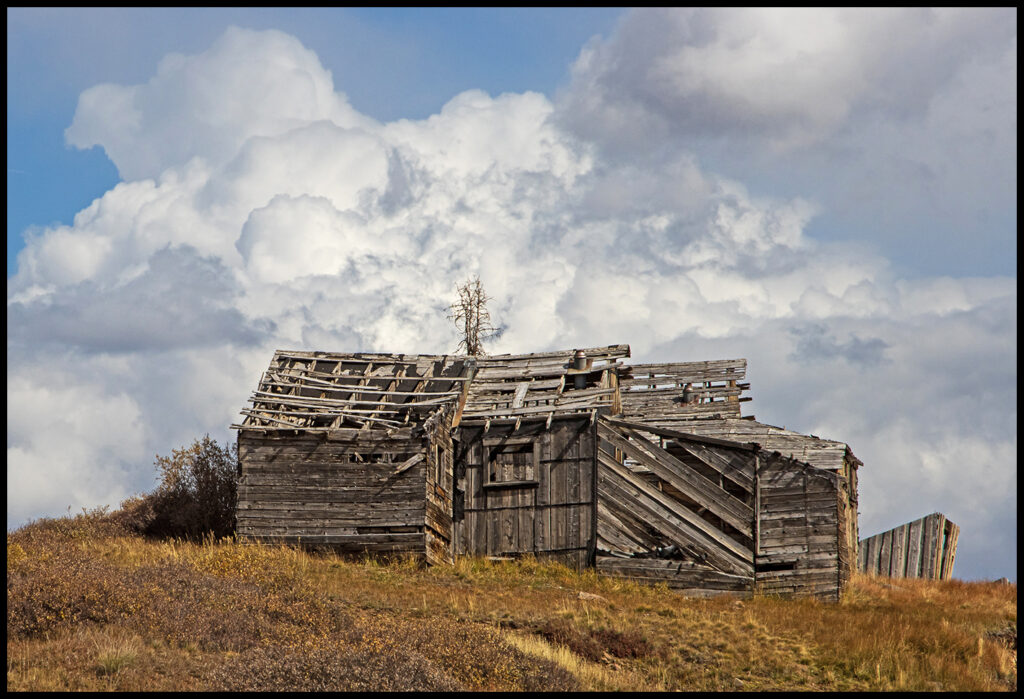
We backtracked from Creede a bit to the Middle Creek Rd. Left on forest road 528. Just pass the junction with FR526 we turned up a small hill to discover a wonderful campsite. This whole area deserves a lot more time to explore, but we only had 8 days so had to keep moving.
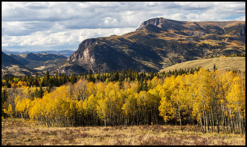
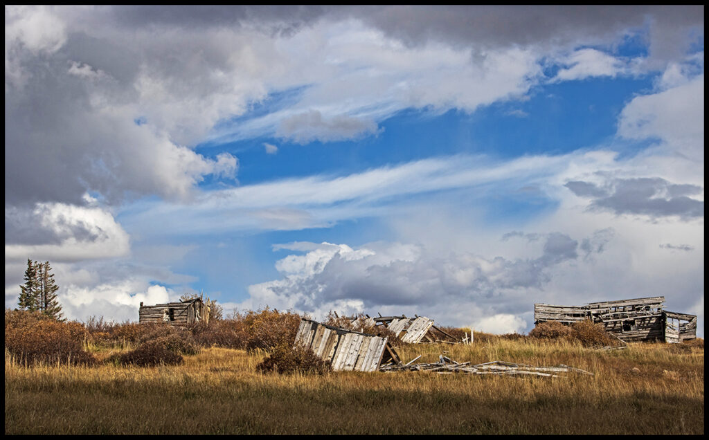
View from FR 526. Panorama at the blog beginning was taken from here also.
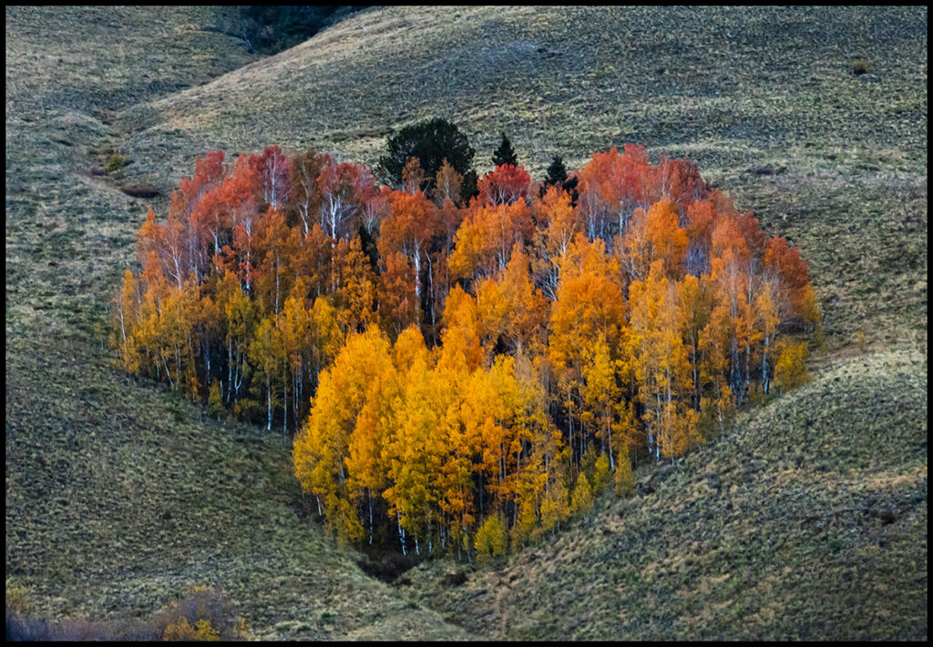
Across the valley was an aspen grove heart.
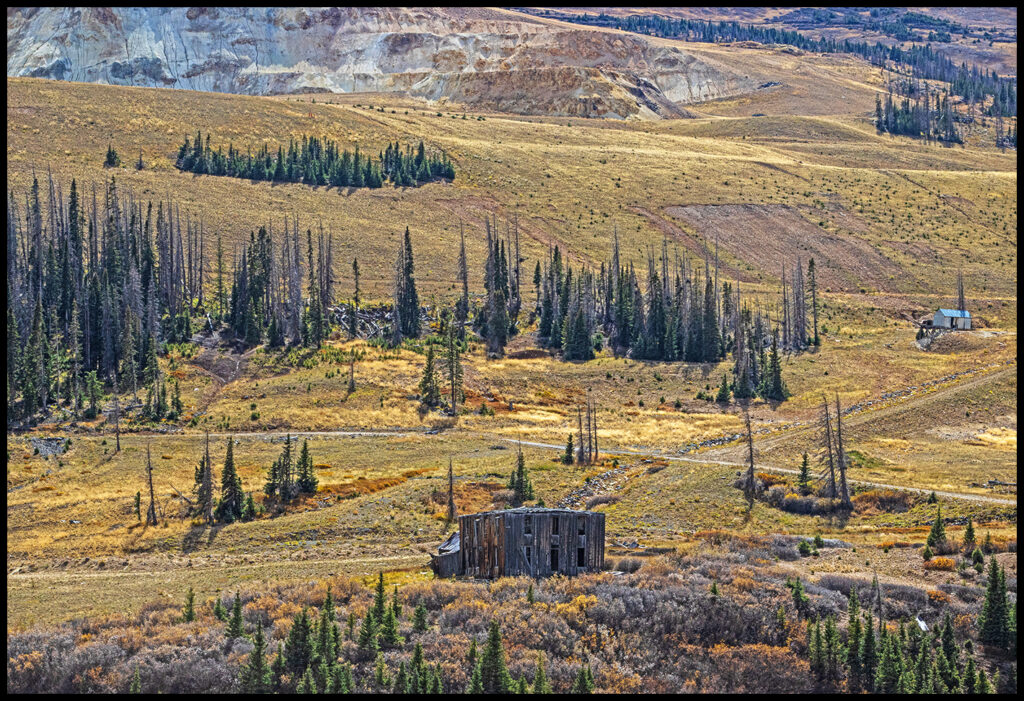
I wanted to revisit Summitville, an old mining area we’d ridden through on motorcycles many years before. One can get to Summitville from South Fork or Del Norte. We chose to go 25 miles south of Del Norte on the aptly named Summitville Rd. The Summitville mine’s claim to infamy is the 1980s environmental damage caused by leakage of toxic by-products into the Alamosa River. (This is not related to the more recent Gold King mine disaster of 2015 which turned the Animas River yellow).
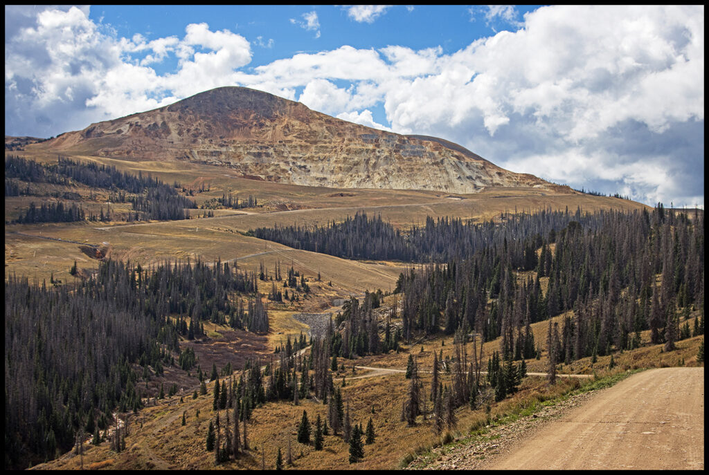
Summitville valley.
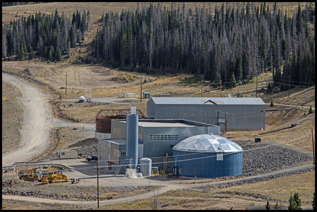
The mine in the distance.
By 1885 there were more than 250 individual claims in operation. The site was soon mined out. It was re-opened a number of times with little success. The weather at the 11,500’ high site didn’t help matters. In 1984 the Canadian-based Galactic Resources, Ltd. acquired the site and began a large-scale open pit operation involving the treatment of uneconomic ore with a sodium cyanide solution to leach out gold. They leached around 10 million tons of tailings ore on a 73-acre heap leach pad. A total of 9,155.8 kg of gold and 9,947.3 kg of silver was recovered. In 1992, Galactic Resources filed for bankruptcy, closed the site and converted on-site equipment to the detoxification process.
Part of the Superfund clean up operation.
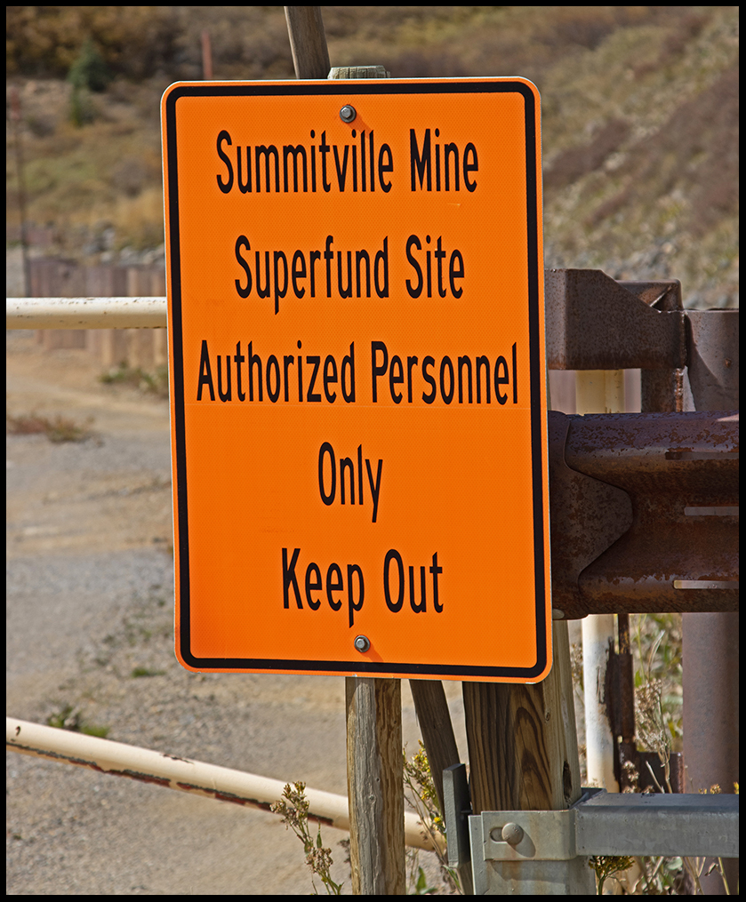
After bankruptcy proceedings were completed in a British Columbia court, the US Government declared the site an EPA Superfund cleanup site and spent $155,000,000 of public funds cleaning up the site. Galactic Resources Ltd. paid around $30 million in settlement. The site clean-up continues today. When we rode through over 20 years ago clean-up hadn’t started yet.
There are some signs declaring the old townsite a historic restoration project, but little in the way of progress on that front is obvious to a casual observer.
Summitville townsite
An old hotel or boarding house below the mine.
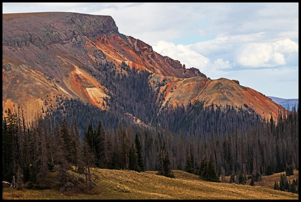
Leaving Summitville we passed a very red mountain. In the southern part of the state, these mountain soil colors are common.
Following the dirt roads to Platoro we stumbled on the free forest service Stunner Campground. It was a Saturday during peak leaf season and we had the place to ourselves. Didn’t see or hear another vehicle. In 1892 there were 400 miners and/or gamblers living on the spot. Most rushed on following reports of richer strikes. Prospect pits littering the surrounding hillsides are all that’s left.
View from Stunner campground.
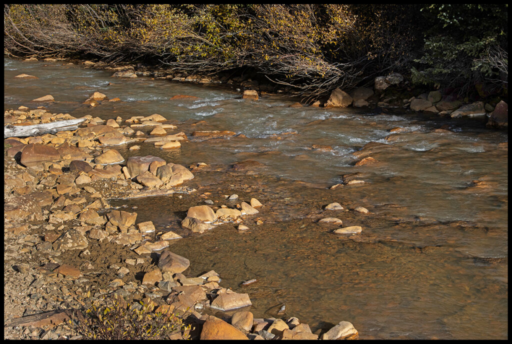
Creek water color residual from mining days.
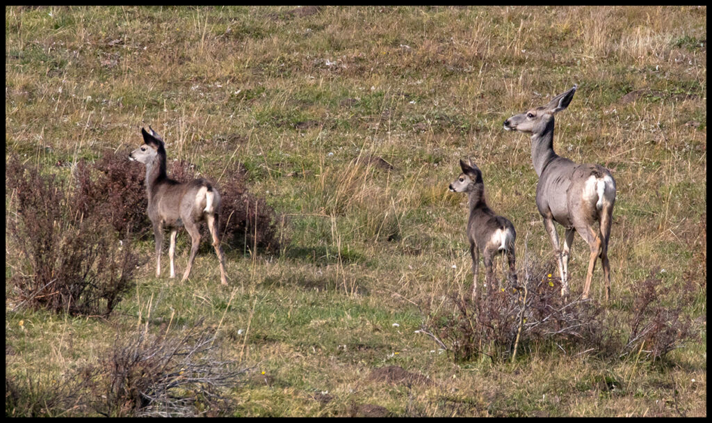
Mule deer family; camp visitors.
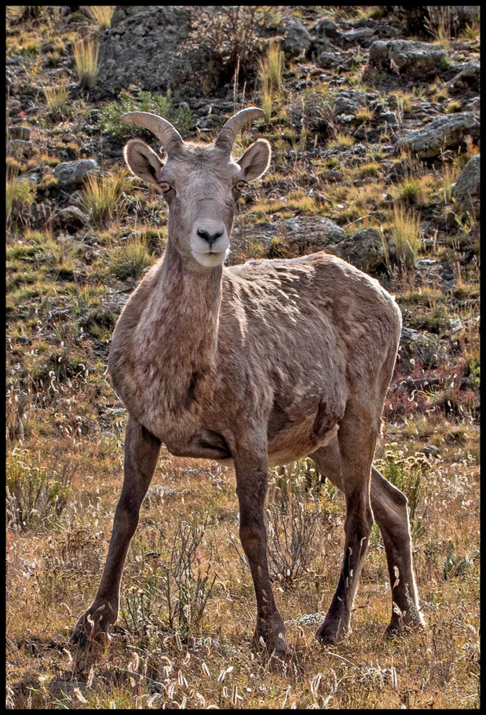
With a little time left we ventured into a new area near Buena Vista. Exit 285 on CR307, then take CR187 south for Castle Rock Gulch area. On the drive in, a herd of bighorn sheep relaxed along the road. They clearly weren’t worried about traffic.
Bighorn female
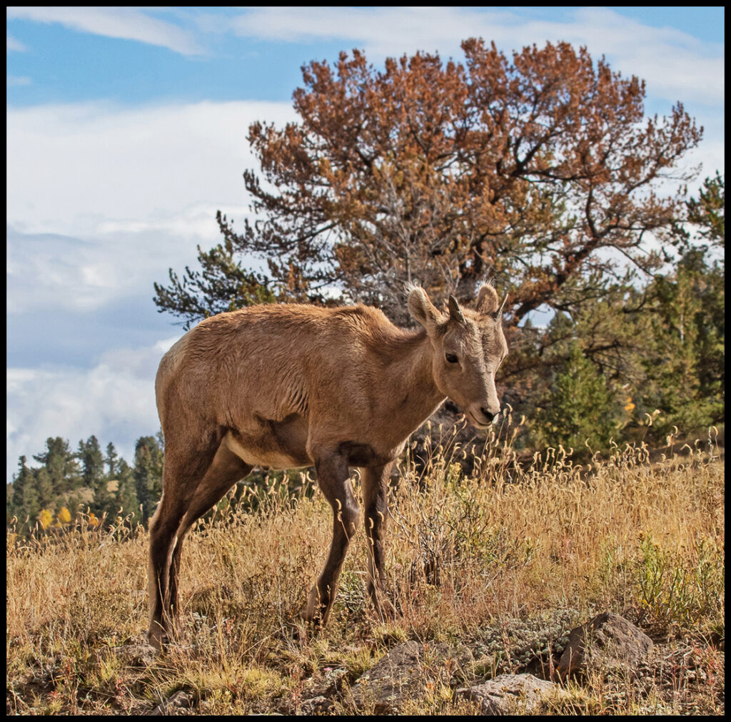
Bighorn lamb.
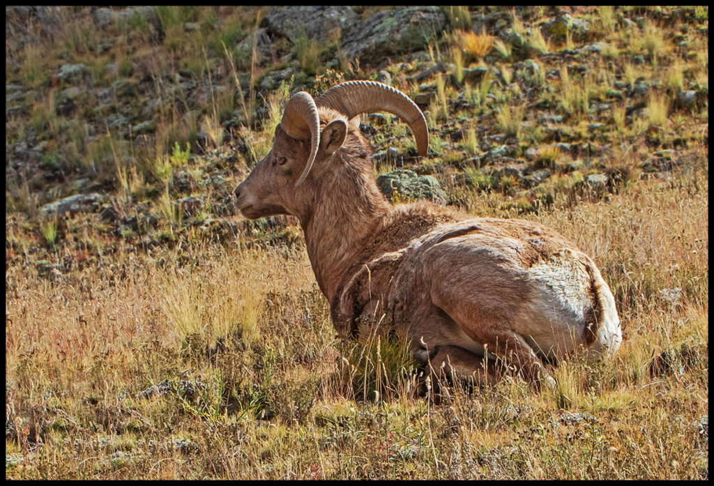
Bighorn ram.
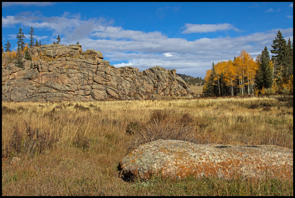
View from the campsite we found.
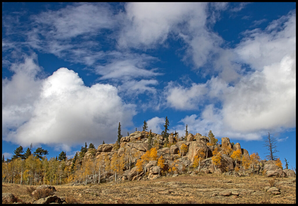
Turn 90 degrees and this was the view.
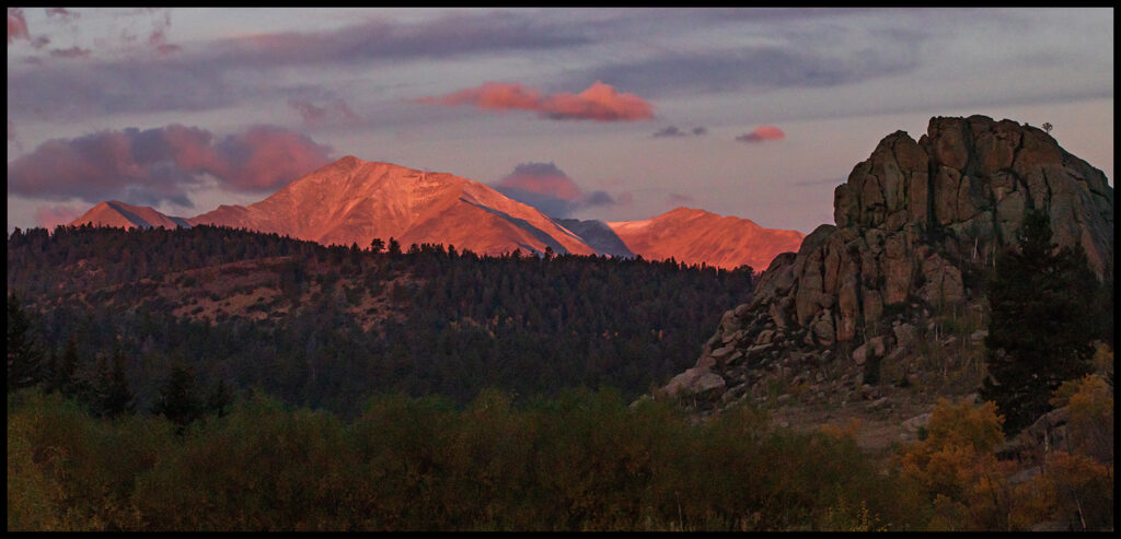
Alpenglow visible the next morning from camp.
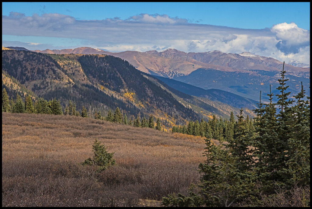
We followed that road all the way through the southern end of South Park emerging on highway 9. Great camping opportunities all over and good wildlife spotting.
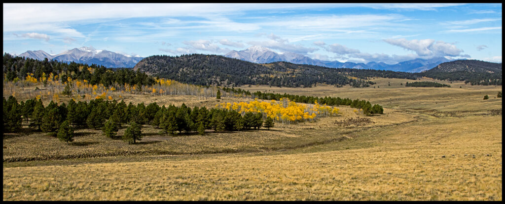
South Park.
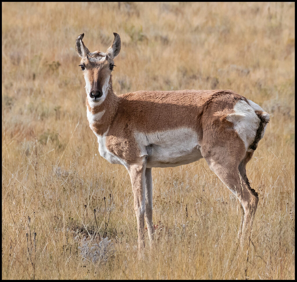
A Pronghorn antelope eyes us not far from the road. It’s unusual to see lone ones, they generally travel in groups.
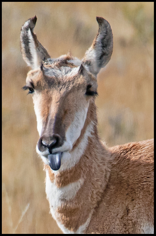
Here’s what she thought of us!
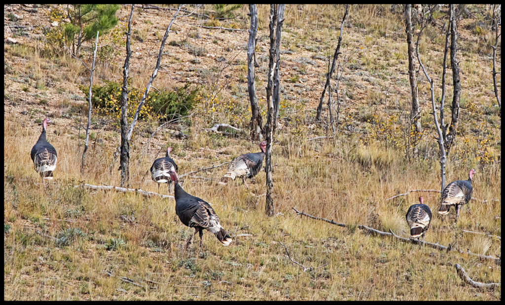
Wild turkeys along the road.
Time’s a-wastin’, we need to skedaddle home. A quick overnight along the Tarryall Road…forest service camping roads fork off frequently. Being close to Colorado Springs, it’s probably busy with ATV traffic on weekends, but quiet during the week.
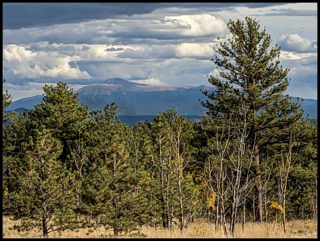
Pikes Peak is visible from Tarryall Road.
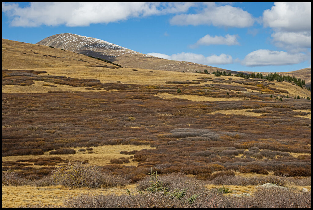
Now, over Guanella Pass Scenic Byway, elevation 11,670 with several looming 14ers. The winding paved road lands one in the quaint, touristy town of Georgetown featuring lots of preserved Victorian architecture. After Georgetown it’s a quick jaunt home where we can start thinking about our next adventure!
Top of Guanella Pass.
Above treeline on Guanella Pass, October 2nd the first dusting of snow .
As always, thanks for coming along.
As promised the link to the Cadwell’s place.
https://www.cathedralcabins.com/